 Holmes Hub
Manual
Everything Holmes Hub can do, with pictures. 155 places, 87 stories, four maps of the time and five districts in 3D.
Nothing in the manual matches that. Try fewer words, or search the map itself.
Getting started
“You see, but you do not observe.”Sherlock Holmes, A Scandal in Bohemia
Holmes said it to Watson, and he could have said it to most of us walking through London today. Holmes Hub is an attempt to help you observe, at least as far as 1889 is concerned.
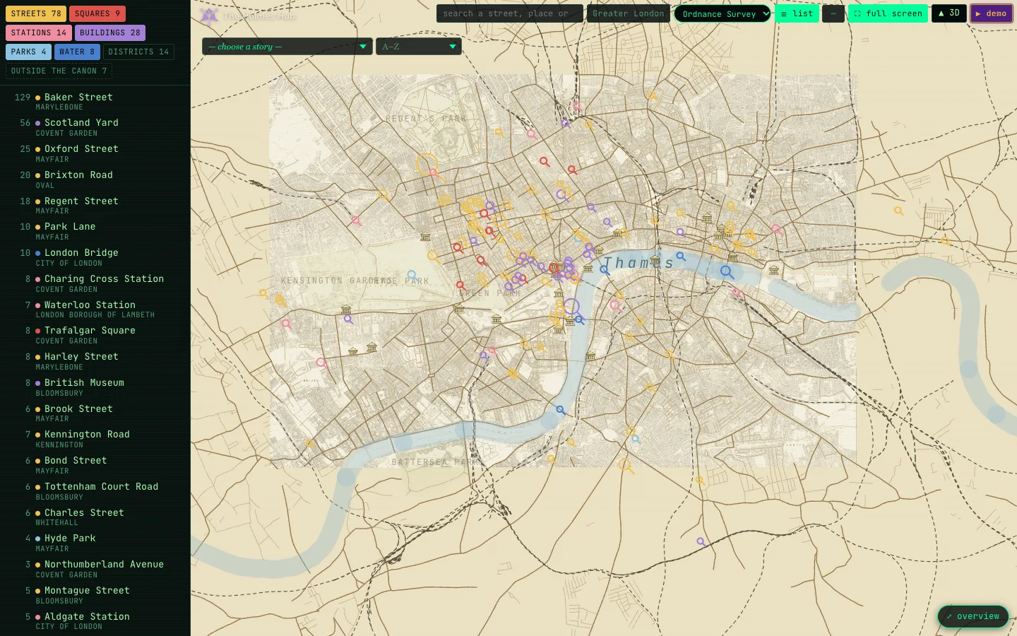
Holmes Hub puts the London of the Sherlock Holmes stories on the map as it stood in 1889. Every street, station, square and building that Arthur Conan Doyle names, 155 placesAll 155 places, most mentioned first. Click one to open it on the map.Baker Street129×Scotland Yard56×Oxford Street25×Brixton Road20×Regent Street18×Brixton14×Camberwell13×London Bridge10×Park Lane10×British Museum8×Charing Cross Station8×Harley Street8×Lee8×Trafalgar Square8×Blackheath7×Kennington Road7×Lewisham7×Sydenham7×Waterloo Station7×Beckenham6×Bond Street6×Brook Street6×Charles Street6×Gloucester Road Station6×Norbury6×Tottenham Court Road6×Upper Norwood6×Aldgate Station5×Edgware Road5×Langham Hotel5×Montague Street5×Streatham5×Covent Garden4×Cross Street4×Hyde Park4×Leadenhall Street4×Mortimer Street4×Pitt Street4×Carlton Club3×Cavendish Square3×Charing Cross Hospital3×Christie's3×Euston Station3×Fleet Street3×Greenwich3×Lower Norwood3×Northumberland Avenue3×Vere Street3×Albert Dock2×Bentinck Street2×Berkeley Square2×Bow Street2×Café Royal2×Cannon Street2×Carlton House Terrace2×Commercial Road2×Conduit Street2×Duncan Street2×Fenchurch Street2×Goodge Street2×Gordon Square2×Great George Street2×Grosvenor Square2×Hanover Square2×Haymarket Theatre2×High Street Station2×Kennington Lane2×Lambeth2×Liverpool Street2×London Bridge Station2×Lowther Arcade2×Mincing Lane2×Paddington Station2×Shaftesbury Avenue2×Simpson's2×Sotheby's2×St. James's Hall2×Threadneedle Street2×Turkish Bath, Northumberland Avenue2×Victoria Street2×Waterloo Bridge2×Welbeck Street2×Wigmore Street2×Woolwich Station2×Albert Hall1×Blackheath Station1×Blandford Street1×Broad Street1×Camberwell Road1×Campden House Road1×Charing Cross Hotel1×Chislehurst Station1×Church Row1×Church Street1×Church Street, Kensington1×Claridge's1×Cox and Co.1×Craven Street1×Criterion Bar1×Crystal Palace1×Curzon Square1×Curzon Street1×Downing Street1×Endell Street1×Farrington Street1×Fulham Road1×Glasshouse Street1×Grand Hotel1×Gray's Inn Road1×Great Peter Street1×Grosvenor Hotel1×Half Moon Street1×Hammersmith Bridge1×Holborn Restaurant1×Kennington Park1×King Edward Street1×King's College Hospital1×King's Cross Station1×Lime Street1×Little George Street1×Lombard Street1×London Library1×London Road1×Lyceum Theatre1×Manchester Street1×Marylebone Lane1×Metropolitan Station1×Miles Street1×Montague Place1×Museum of the College of Surgeons1×New Street, Wallington1×Old Deer Park1×Paul's Wharf1×Peckham1×Queen Anne Street1×Robert Street1×Rochester Row1×Russell Square1×Ryder Street1×St James's Square1×St James's Street1×St Paul's Cathedral1×St. Pancras Hotel1×Stockwell Place1×Throgmorton Street1×Vauxhall Bridge1×Vauxhall Bridge Road1×Victoria Station1×Waterloo Bridge Road1×Waterloo Road1×Wellington Street1×West India Docks1×Westminster Bridge1×Westminster Road1×Wimpole Street1× in all, sits where it stood, on the streets of the time. You can read the stories, fly through five districts in 3D, lay four maps of the period under the city, and let a demo tell a story for you.
Nothing needs setting up: the map works the moment it opens. This manual tells you what every button does, and a few things the buttons do not tell you. Use the search box above to find a word anywhere in it, or the index to jump to a chapter.
“It is a capital mistake to theorise before one has data.”Sherlock Holmes, A Scandal in Bohemia
So here is the data: every place Doyle names, the maps of his day, and a few hundred photographs, each one looked at by hand. The theorising we leave to you. No deerstalker required, by the way: the word never appears in the stories. Watson calls it an “ear-flapped travelling-cap”, and only once.
A quick tour
“Come, Watson, come! The game is afoot.”Sherlock Holmes, The Abbey Grange
Five steps, about as many minutes, and no need to get dressed in a hurry:
- Click a dot on the map. The card shows Doyle’s own sentence, photos of the place and every story that mentions it.
- Choose a story (top left of the map). The map shows only that story’s London.
- Press ▶ demo. The story is told stop by stop, with the old map lifting off the city at every place.
- Press ▲ 3D and fly through Marylebone as it stood, house by house.
- Open the library and read. Every place in the text links back to the map.
Lost somewhere between two maps and three stories? That is the right place to be. And if you get properly stuck:
“You know my methods. Apply them.”Sherlock Holmes, The Sign of the Four
Or, less mysteriously, read on. Every quotation in this manual was checked word for word against the stories.
The flat map
“It is a hobby of mine to have an exact knowledge of London.”Sherlock Holmes, The Red-Headed League
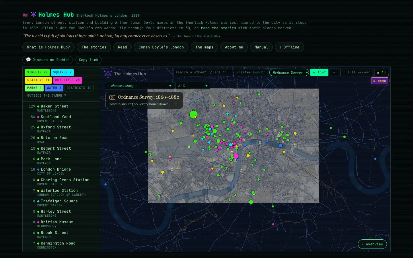
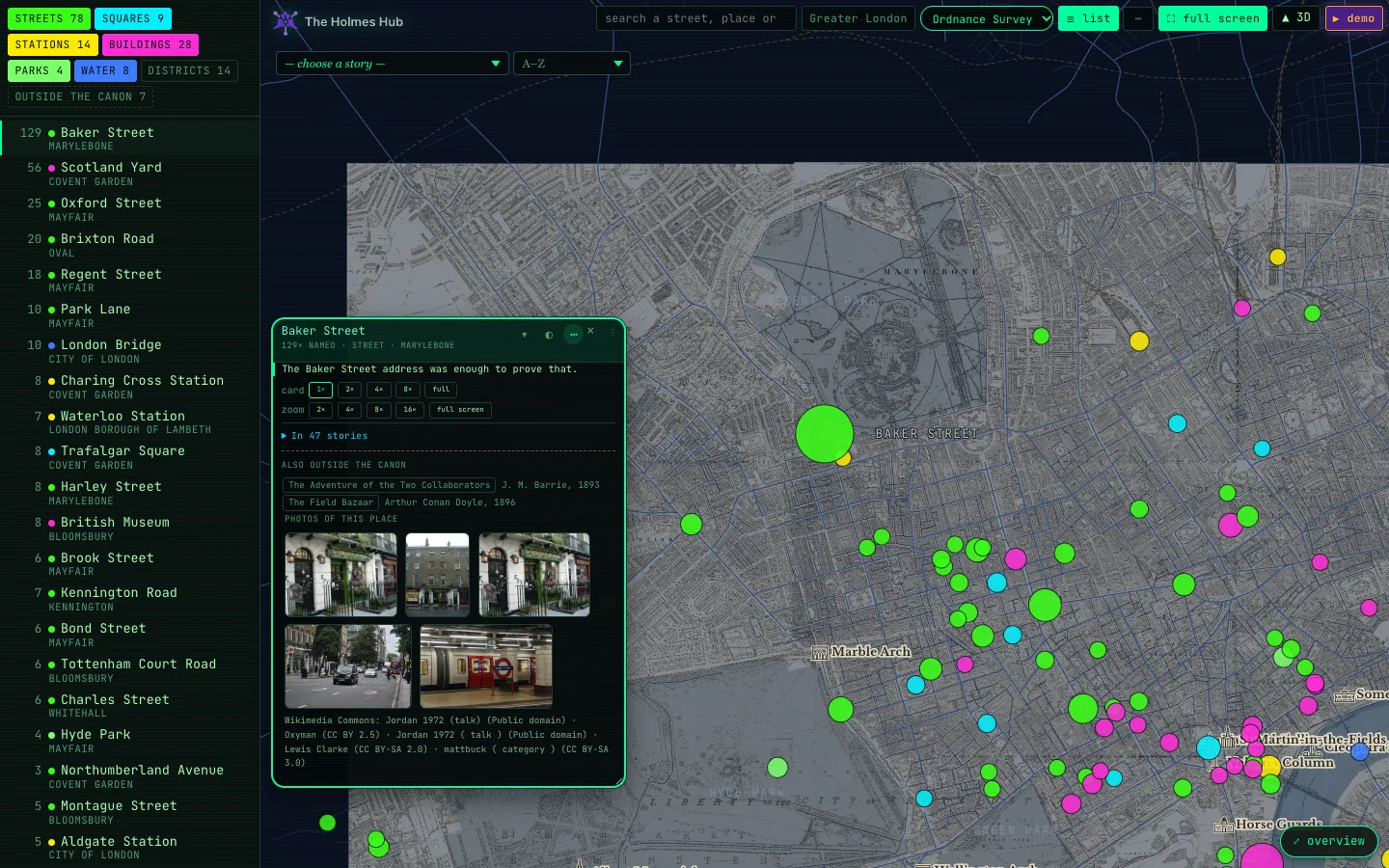
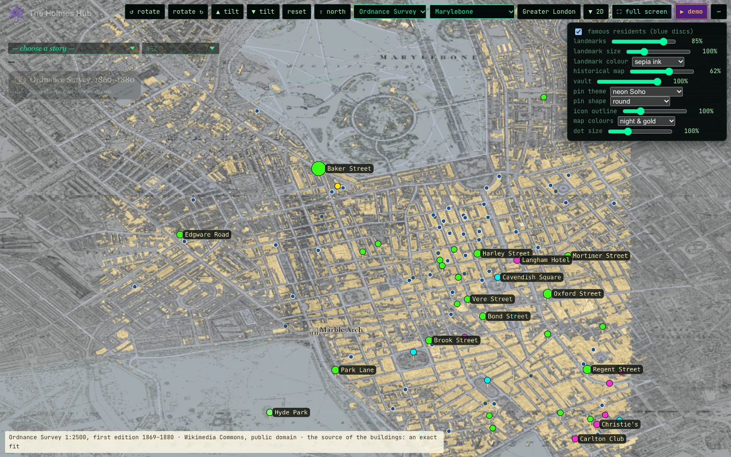
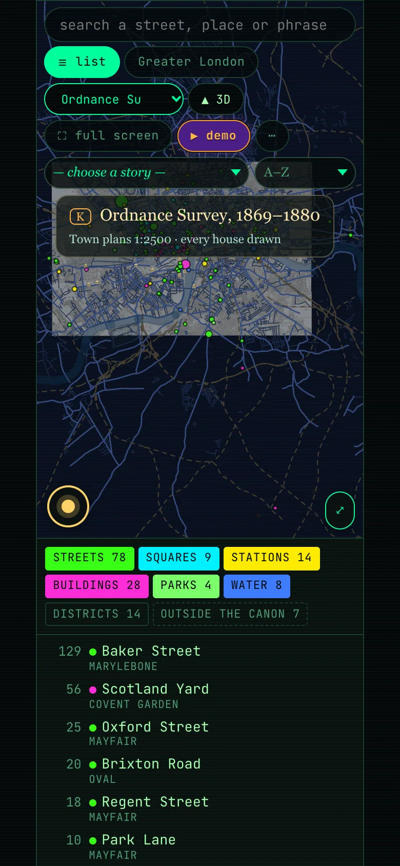
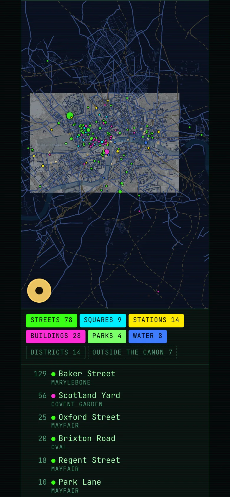
Dots are the places Doyle names; the bigger the dot, the more often he names it. Hover for a preview, click for the card. Tap or click an empty spot to close the card again.
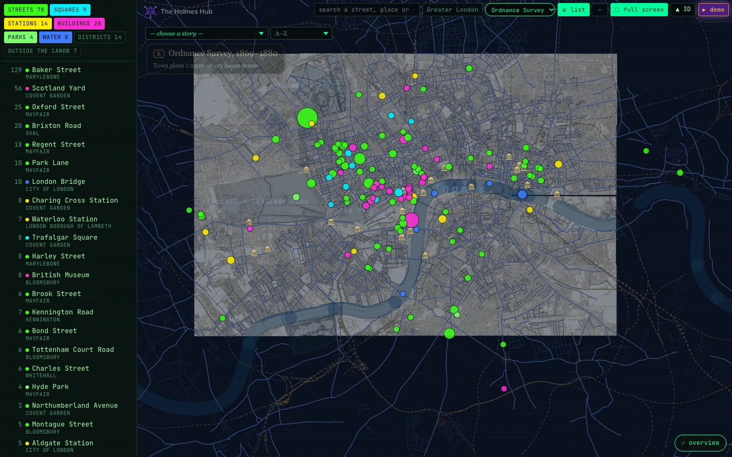
The category chips (streets, squares, stations, buildings, parks, water, districts, outside the canon) switch groups of places on and off. The list on the left sorts them by the number of mentions; click one to fly there. Press L or the ≡ list button to hide it.
Landmarks
Small engraved buildings, in the sepia of an old map, mark landmarks that already stood in 1889: Big Ben, Westminster Abbey, the Tower, Nelson’s Column, Buckingham Palace, the Monument, the Bank of England, the Law Courts, Cleopatra’s Needle and more, twenty-three in all. They are there to find your way, not places Doyle names, so they do not appear in the list or the demo. Each is drawn as a miniature of itself, as it stood in 1889: Big Ben’s tower, the Abbey’s two west towers, the Tower’s keep, the obelisk on the Embankment. Click one for its card, with photographs and engravings from its own day. From a distance you see only the little building; zoom in and the name appears. Hover for a line about it. Where Doyle names the building himself, as with St Paul’s or the British Museum, his own pin takes its place. The landmarks slider in the … menu fades them from full strength to nothing; at 0% they are gone. landmark size makes the buildings and their names smaller or larger, up to two and a half times, and landmark colour picks the ink: sepia, black, oxblood, Prussian blue, gaslight gold, or white on black for the darker maps. Your settings are remembered, on the flat map and in 3D alike.
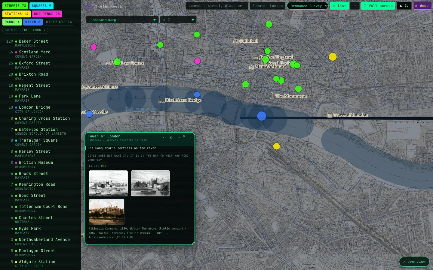
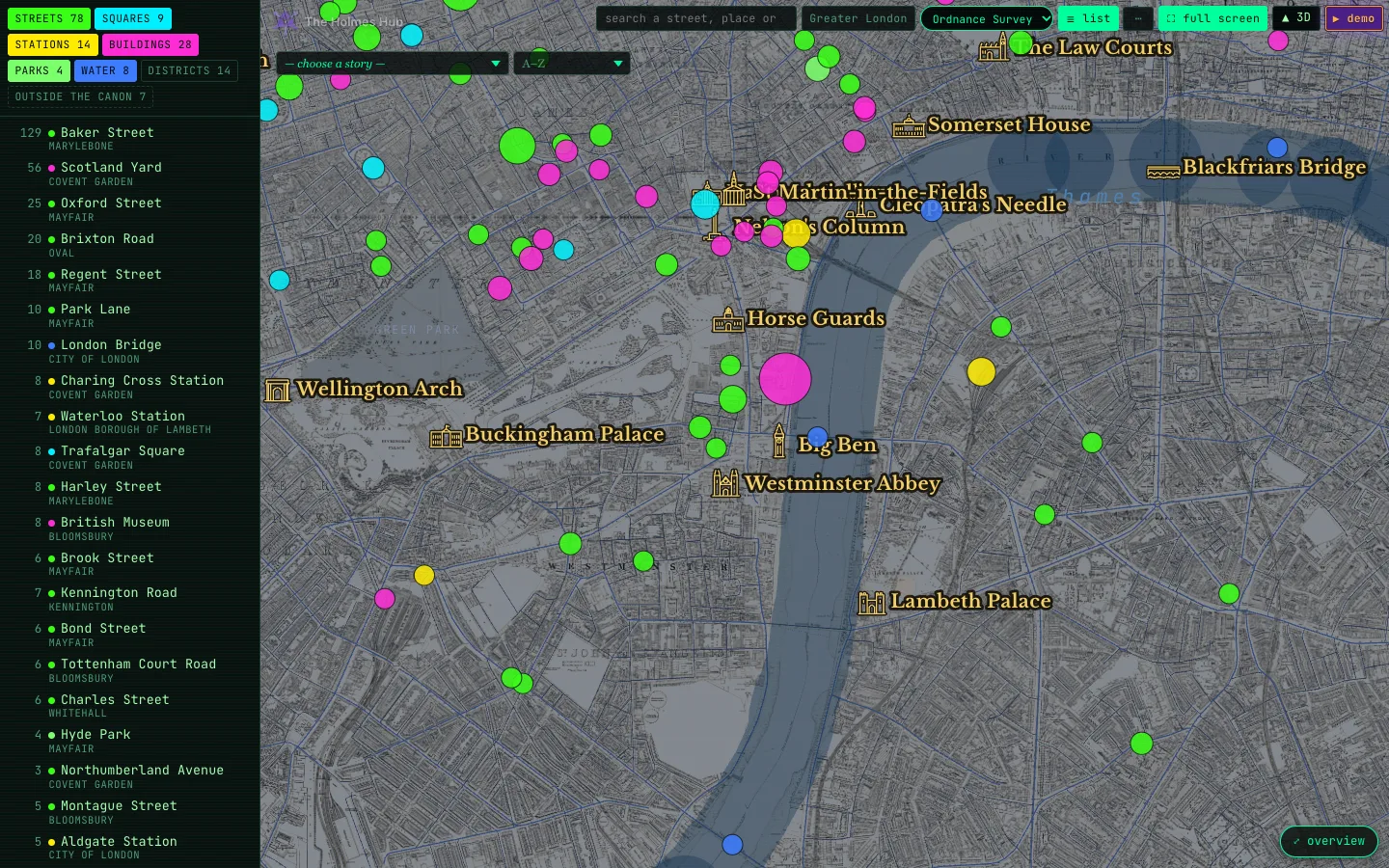
⤢ overview (bottom right) always brings you back to all the places. Full screen (or F) gives the map the whole screen; Esc leaves it.
The card
A card tells you what the place is, how often Doyle names it and in which stories, with the sentence in which he names it. Under Photos of this place are pictures of the place itself, the oldest first; every one of them was looked at by hand, and where no honest picture exists there is none. on the map shows that story’s London; read opens the story at the paragraph where the place appears.
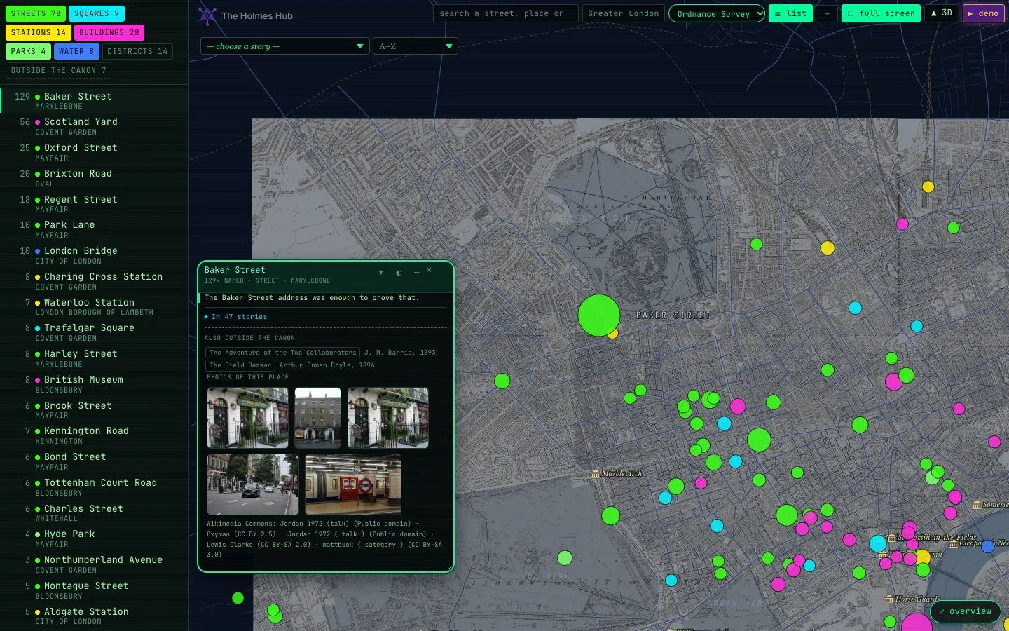
Hover or click: preview and card
Hover over a dot and a small dark label appears: the name, what kind of place it is, the district, how often Doyle names it and in how many stories. It follows your pointer and disappears when you move on. Click and the full card opens, framed in green, and stays open while you look around.
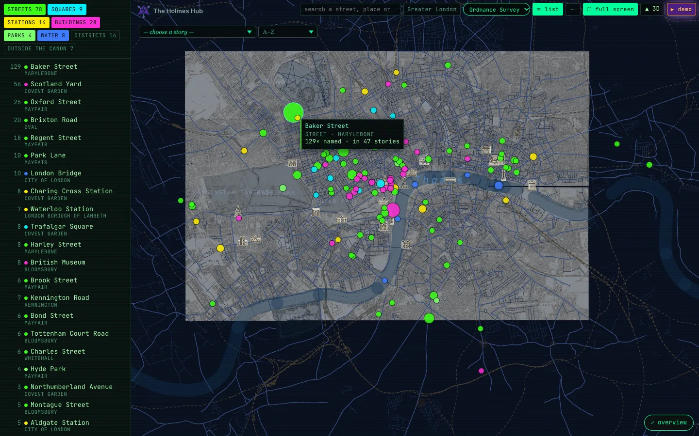
Coloured dots, white buildings
The coloured dots are Doyle’s own places; their colour is their kind (green for streets, blue for squares, orange for stations, pink for buildings, and so on; the pin theme in the … menu changes the palette). The small drawn buildings with white or sepia names are landmarks that already stood in 1889 but that Doyle does not name. Their card says so in one line, and shows the building in its own day instead of the stories.
What you can do with a card
Three small buttons sit in the top right corner of every card:
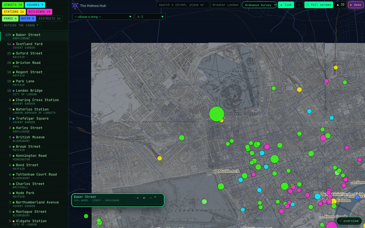
- ▾ fold folds the card away until only its title bar is left, so you can see the map underneath. Click it again, or the title bar, to open it. It stays folded when you pick the next place.
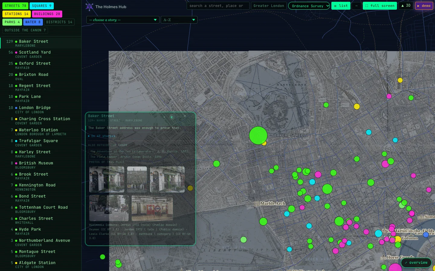
- ◐ see-through makes the card half transparent and lets your clicks pass through it to the map: you can click the pins that lie underneath the card without closing it. Only the buttons in the corner still respond. Click it again for a solid card. The choice is remembered.
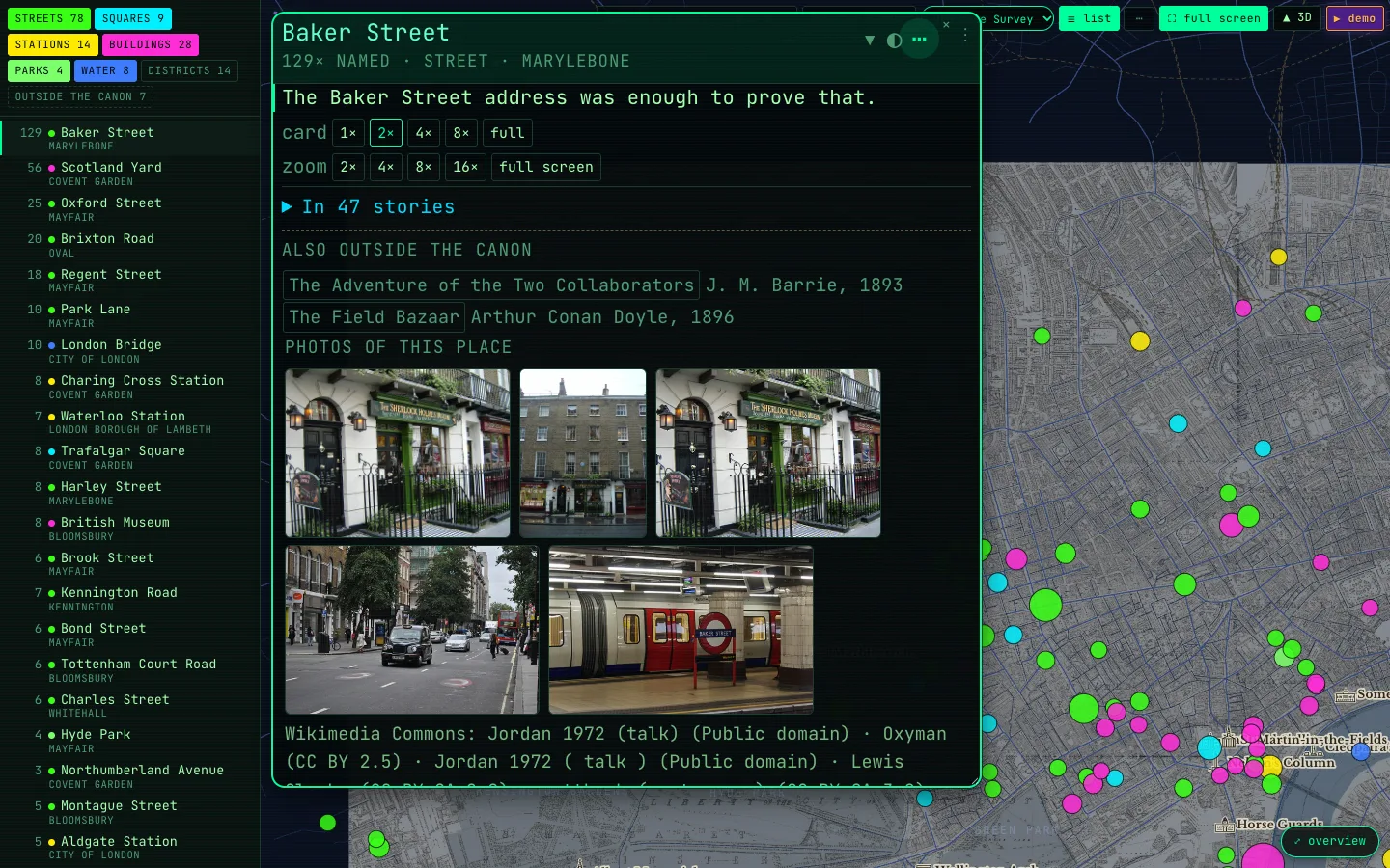
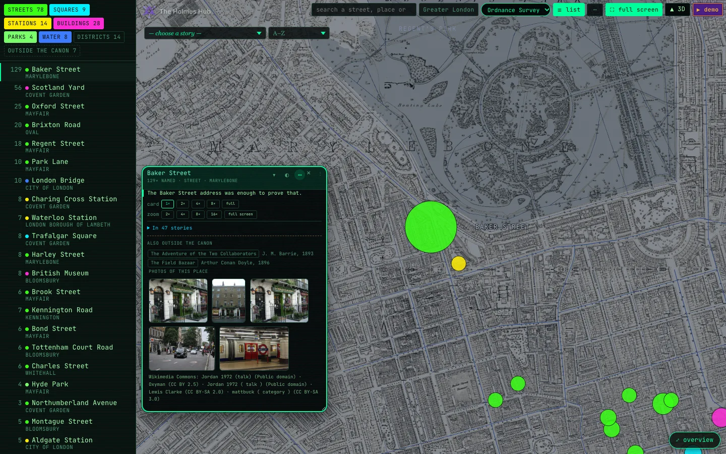
- ⋯ size and zoom opens two rows of buttons. card makes the card itself larger: 1×, 2×, 4×, 8× or full, with the text and the photos growing along. zoom flies the map in on this place at 2×, 4×, 8× or 16×, or switches to full screen. Esc brings an enlarged card back to its normal size.
One story's London
“You know my method. It is founded upon the observation of trifles.”Sherlock Holmes, The Boscombe Valley Mystery
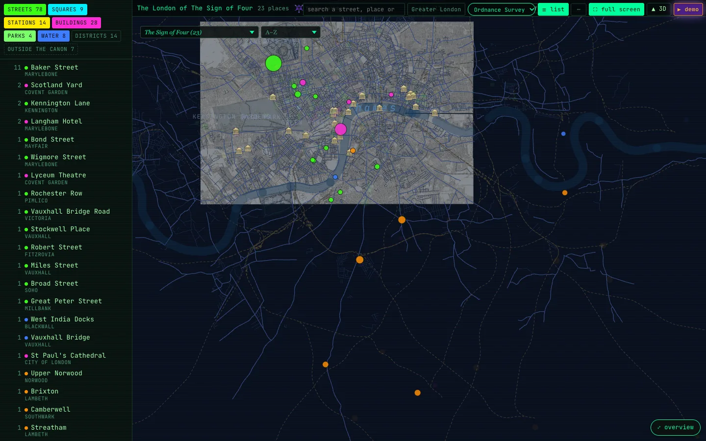
Choose a story (top left of the map) shows only that story’s London and zooms until all of its places are in view. Hover a dot and you see the sentence from that story. × next to the list takes you back to all the places.
Next to it, sort the list of stories: A–Z, most places, most mentions, most spread out, furthest from Baker Street, or most Baker Street.
Search
“Data! data! data! … I can’t make bricks without clay.”Sherlock Holmes, The Copper Beeches
The search box above the map finds everything: the places Doyle names, all 4,090 streets of 1889, even the ones he never mentions, the stories by title, author or year, districts, characters, the names no map has, and every paragraph of every book.
- Several words must all appear. Put a phrase between quotation marks to find it exactly.
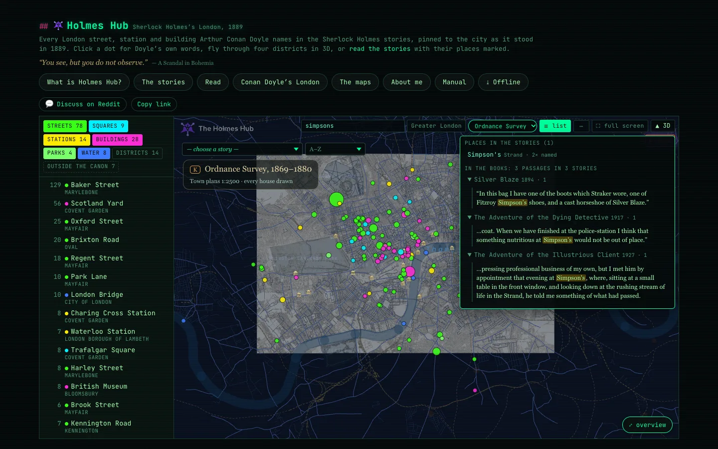
- Accents and apostrophes do not matter: simpsons finds Simpson’s.
- A street is marked with a gold pin; tap the pin to find the street in the books.
- A passage opens the story at that paragraph.
The library has the same search, with a link back to where you were.
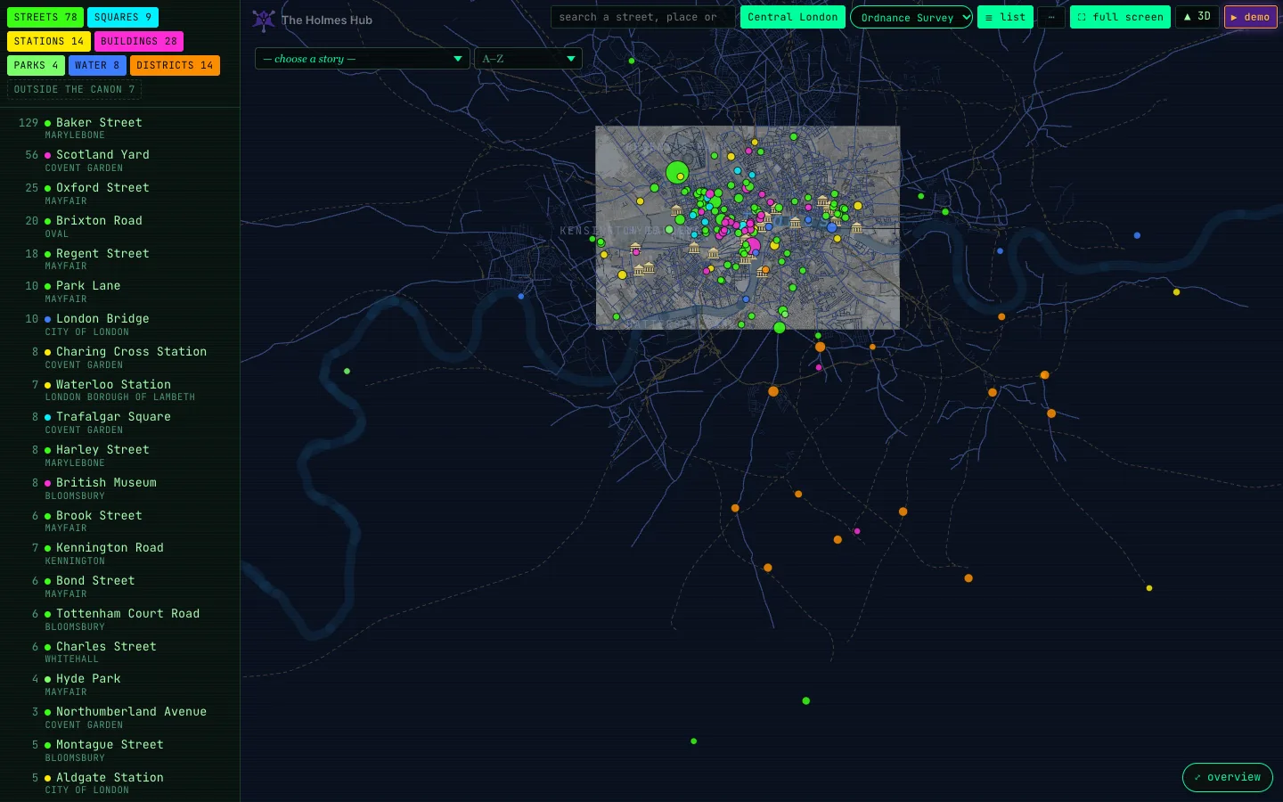
Central and Greater London
“London, that great cesspool into which all the loungers and idlers of the Empire are irresistibly drained.”Dr Watson, A Study in Scarlet
Greater London switches from the centre to the districts further out that Doyle names: Upper Norwood, Norbury, Lee, Blackheath, Chislehurst, Woolwich and more. Central London takes you back.
Maps of the time
“There is nothing so unnatural as the commonplace.”Sherlock Holmes, A Case of Identity
Four maps of the period lie under the city. Press K or pick one in the map list to cycle through them; the name of the map appears top left for a few seconds each time you switch.
- Ordnance Survey, 1869–80: the town plans at 1:2,500, every house drawn. This is where you start.
- Booth 1889: Charles Booth’s poverty map, street by street, from gold (wealthy) to black (vicious and semi-criminal).
- Booth 1898–99: the same survey ten years on.
- Bacon’s map, 1880s: all of Greater London on one sheet, out to Norwood and Croydon.
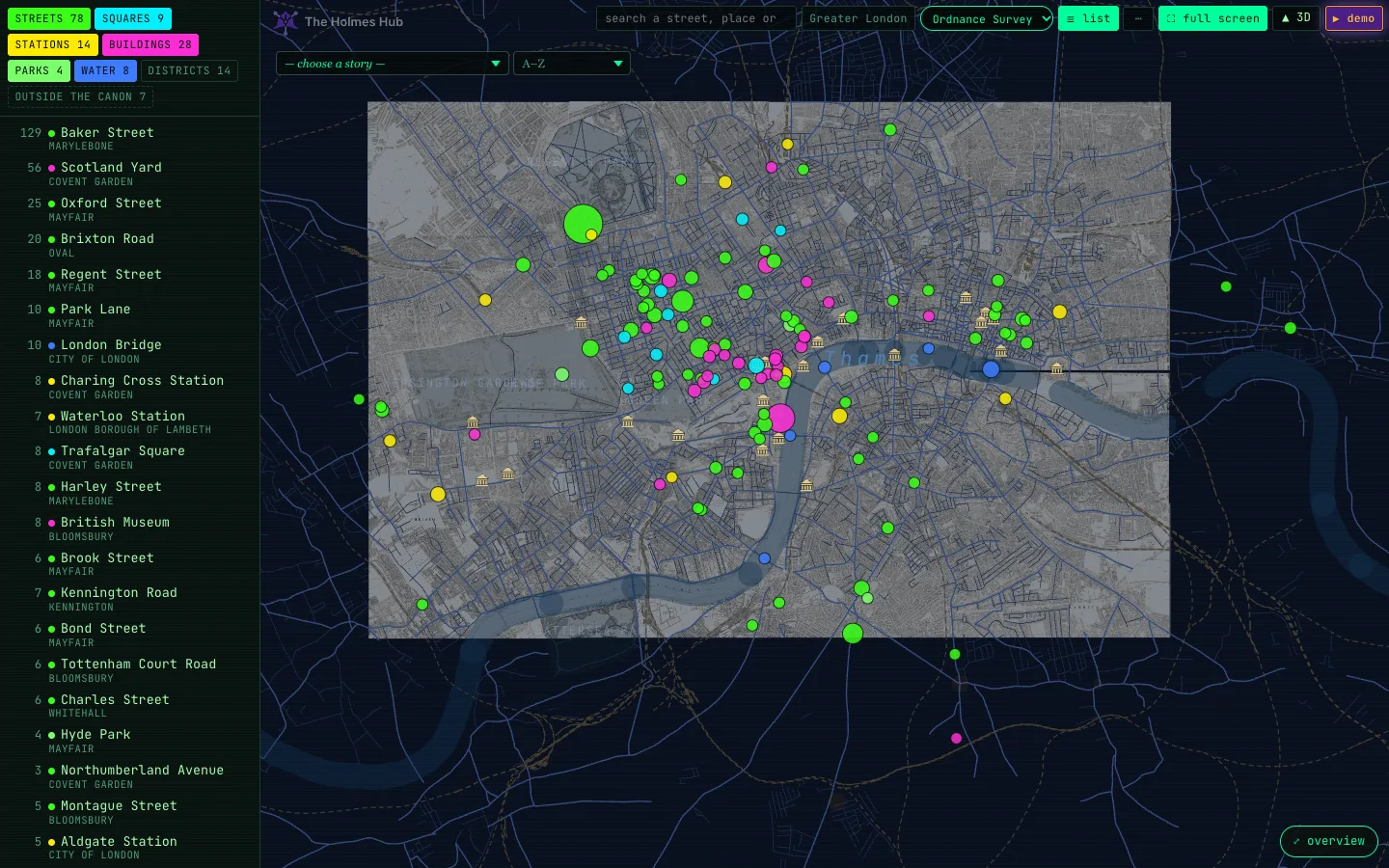
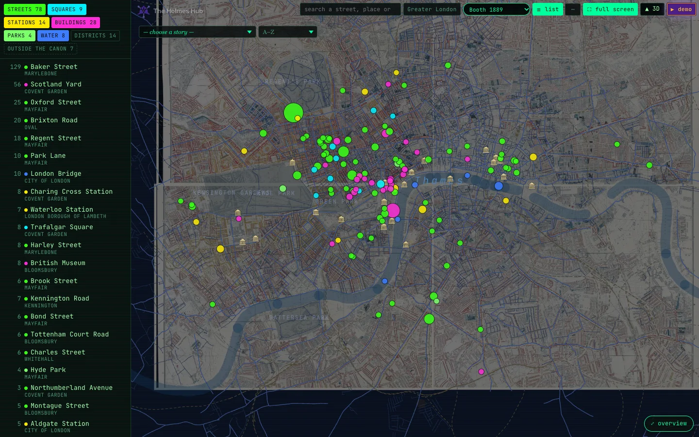
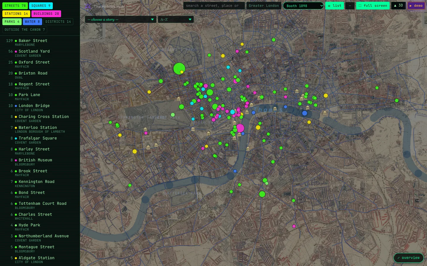
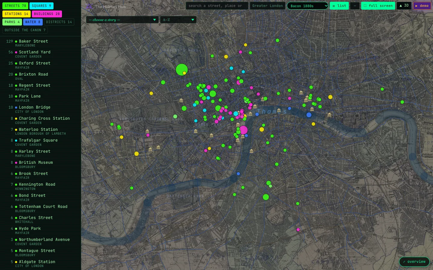
In the … menu, the historical map slider sets how strongly the old map shows through, the Bacon slider does the same for Bacon’s map, and the vault slider sets how strongly our own map of the streets of 1889 shows.
Full-screen map
Full-screen map, in the … menu, shows one of the four old maps across the whole screen with nothing else in the way. The strip at the bottom switches maps and turns the pins on or off. × or Esc closes it.
The maps page
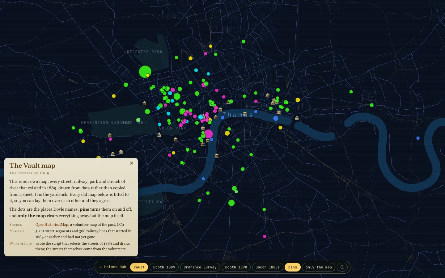
The maps is a page of its own for the old maps: one large map of the streets of 1889, and at the bottom the four old maps. Pick one and it flows in under the streets, with a card telling where it comes from, how it was fitted and what AI did and did not do with it. pins shows the places Doyle names, landmarks the buildings of 1889, only the map clears all of it away, and on the Ordnance Survey ▲ raise the buildings lifts the buildings of that sheet in 3D, right where you are looking.
Your pins and colours
“I have trained myself to notice what I see.”Sherlock Holmes, The Blanched Soldier
The … menu, top right on the flat map and in 3D, sets how the places look and the colours of the map. It remembers your choice on this device.
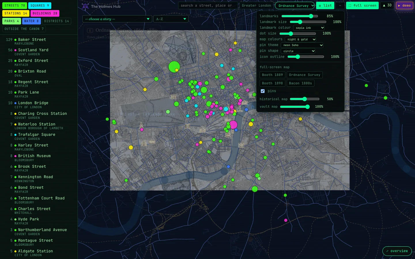
- landmarks: how strongly the buildings of 1889 that help you find your way show, from 100% to off.
- landmark size and landmark colour: how large the landmarks and their names are, and in which ink they are drawn.
- dot size: smaller for the crowded centre, bigger on a phone.
- pin theme: a colour per kind of place. Neon Soho is where you start; Holmes Hub uses the colours of the chips; Booth 1889 borrows the poverty map’s gold, red and blue; ink & sepia, gaslight, brass & fog and Victorian stamp are quieter and warmer; scarlet and Baker Street by night are bolder; colour-blind safe keeps every kind distinguishable.
- pin shape: round (where you start), magnifying glass, drop, diamond, star, ring, or Holmes himself in profile, filled or as a line. The point of the drop and the centre of the glass sit exactly on the place.
- icon outline: the thickness of the line around each pin, from none to heavy.
- map colours: night & gold (where you start), the vault green, paper, London fog, blueprint, sepia print, gaslight, Thames at dusk or newspaper, for the flat map and the 3D districts alike.
The demo
“The world is full of obvious things which nobody by any chance ever observes.”Sherlock Holmes, The Hound of the Baskervilles
▶ demo runs on its own. On the flat map a red dot travels across a still London, leaving a trail of ink and a numbered seal at every stop. At each place a circle of the old map lifts off the city like a magnifying glass, with the part of the story that happens there and Doyle’s own sentence beside it.
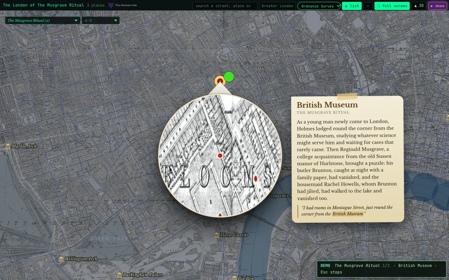
With a story chosen, the demo tells that story; otherwise it picks one. You can click any pin while it runs. Press Esc or click the map to stop, F for full screen. The screen stays awake while the demo runs.
3D
“It is quite a three pipe problem, and I beg that you won’t speak to me for fifty minutes.”Sherlock Holmes, The Red-Headed League
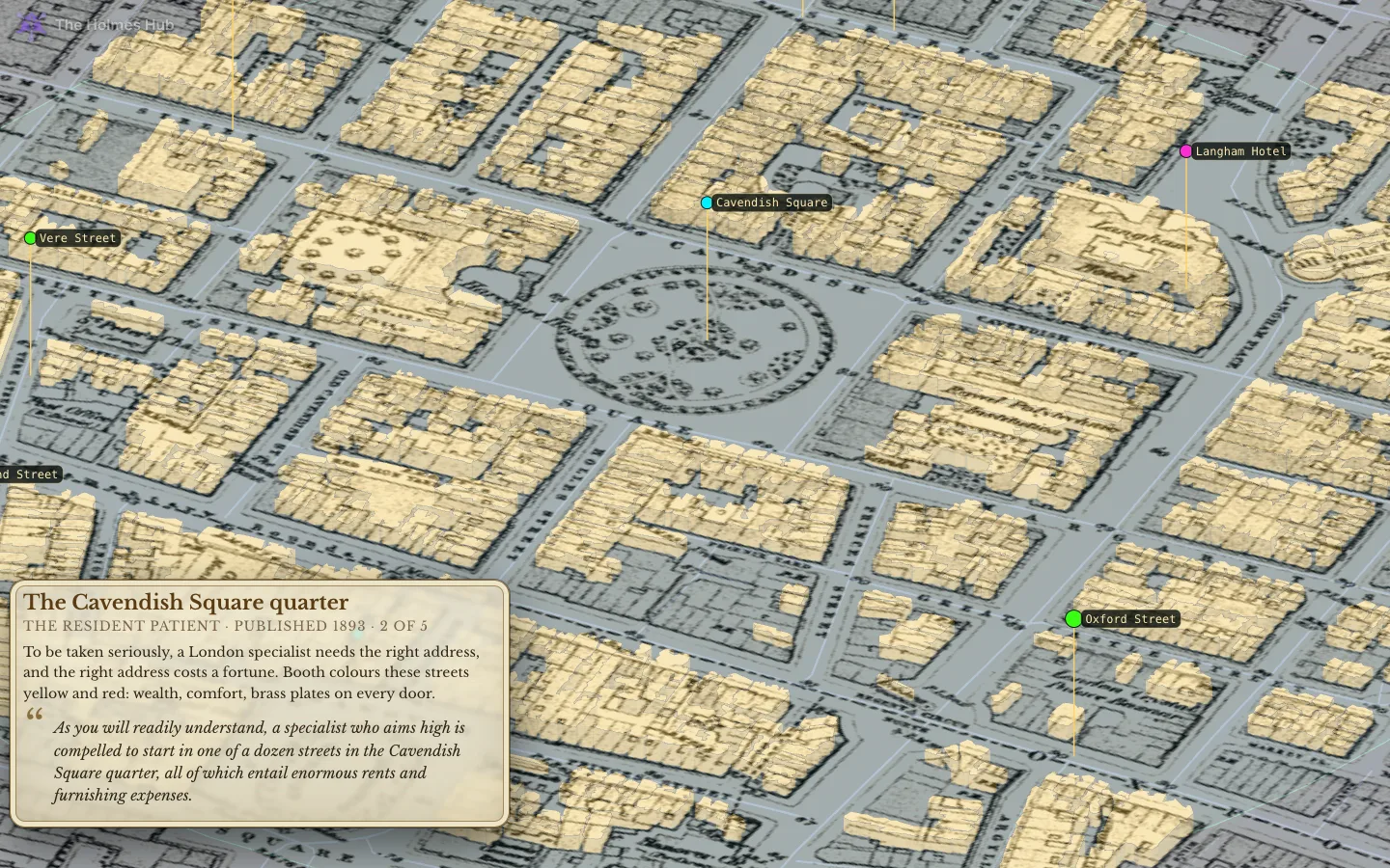
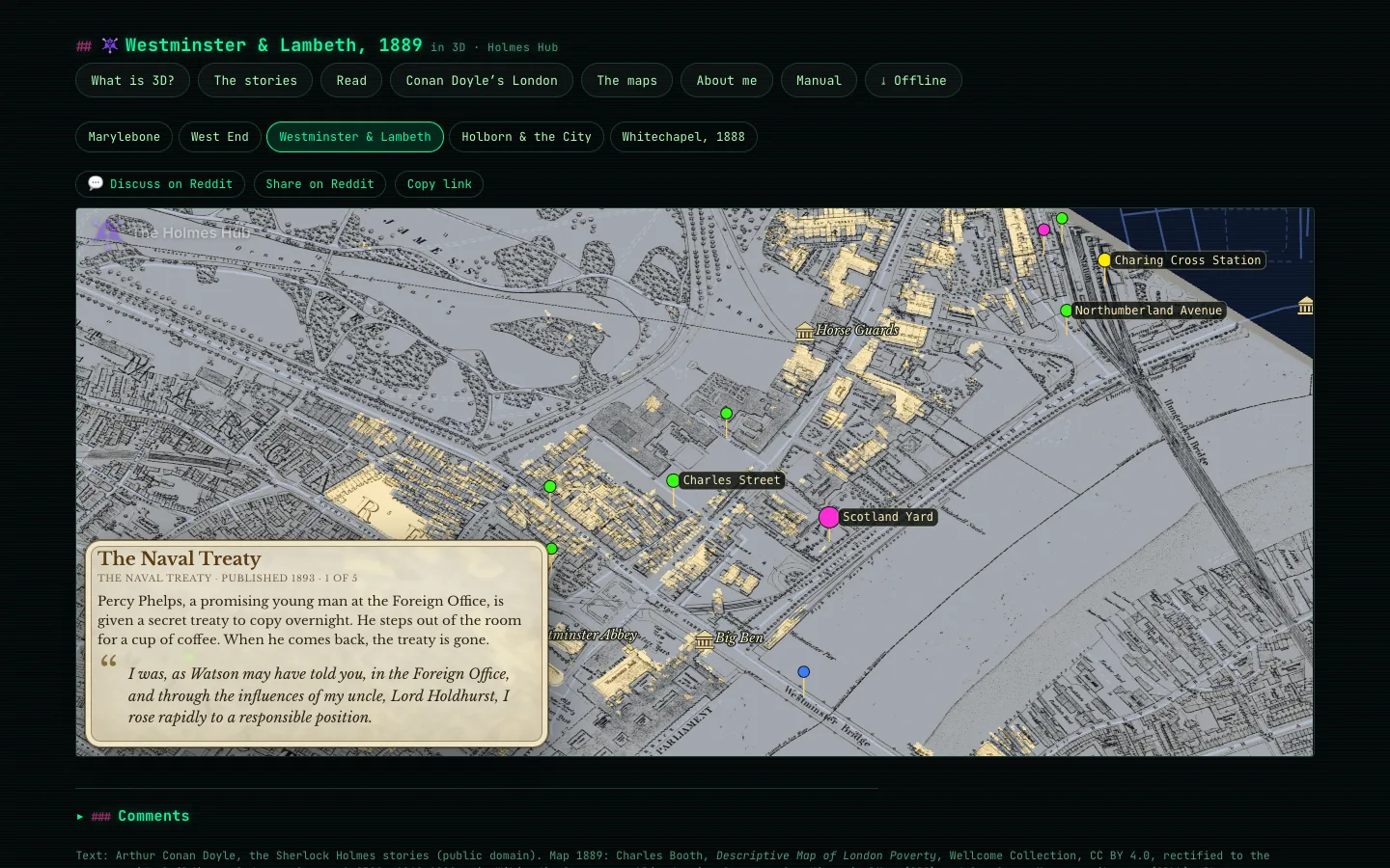
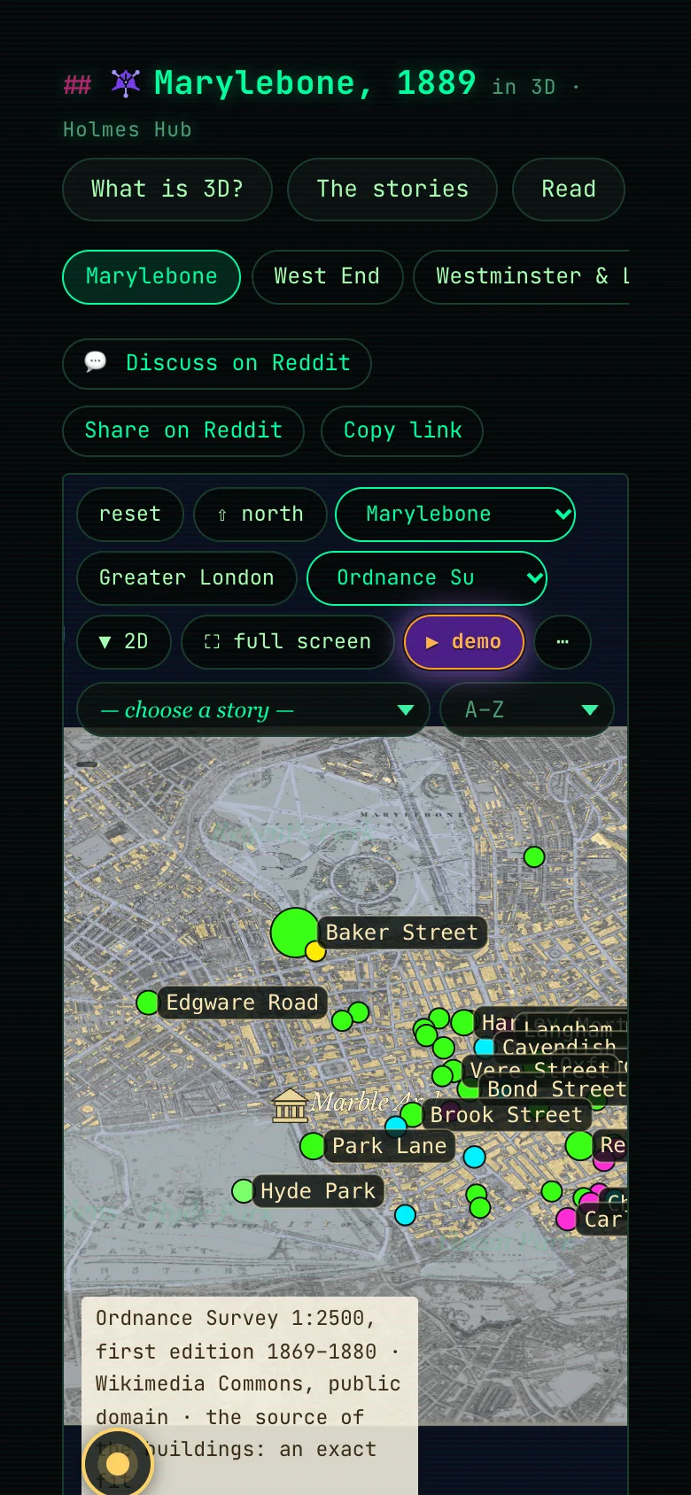
▲ 3D opens a district in three dimensions: Marylebone, the West End, Westminster & Lambeth, Holborn & the City, and Whitechapel in 1888. The buildings are traced one by one from the Ordnance Survey of the 1870s and raised to a height that fits their kind. Where that survey left a block empty, the houses come from the Ordnance Survey of 1891–96 at 1:1056, as traced by Petitpierre and others (2026, CC BY 4.0): that roughly doubles the houses in every district. The old map lies underneath, and the places Doyle names hang above the streets as lights.
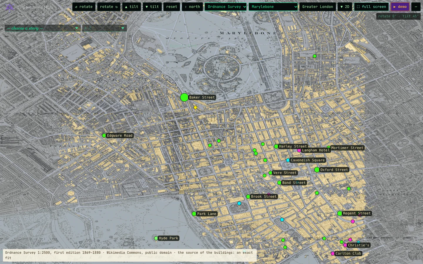
Q/E rotate, W/S tilt, R reset, N north up; drag to pan, scroll to zoom. Click a light for Doyle’s words, a building for its name and photos. Switch district in the list at the top, or pick district and map from the … menu; ▼ 2D takes you back to the flat map. K switches the Ordnance Survey on and off under the buildings; the other old maps are in the list at the top.
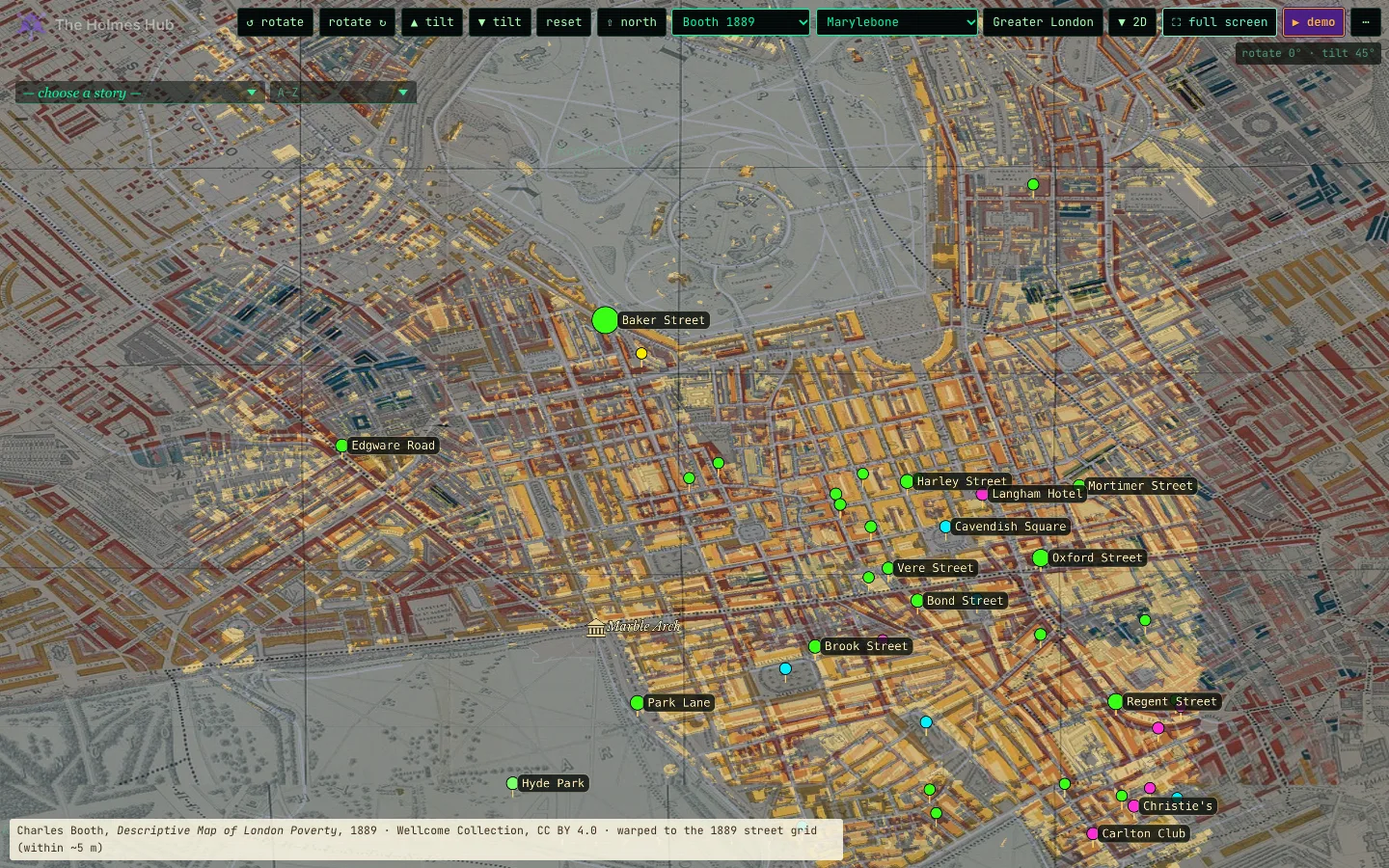
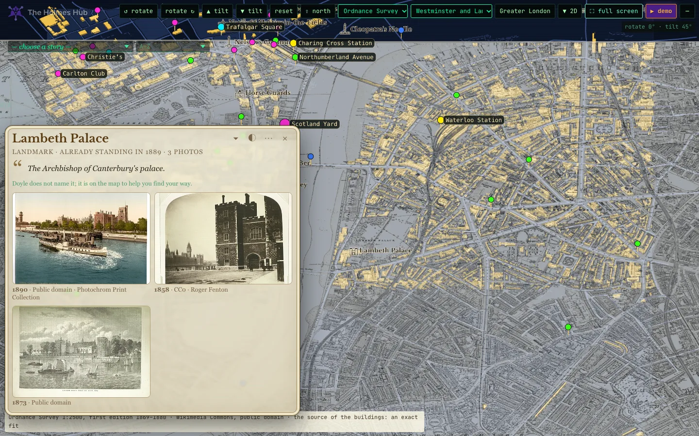
The landmarks stand at roof height in 3D too, so Big Ben rises beside Westminster Bridge and Lambeth Palace across the river.
All of London
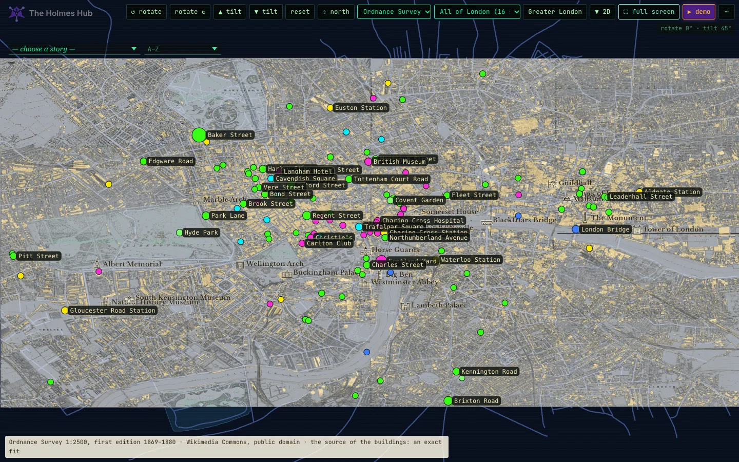
All of London puts every district together: 301,627 buildings from the Ordnance Survey. It is heavy, about 13 MB, so you are asked first; on a phone it runs slowly. Marylebone is the lightest place to start. The Ordnance Survey lies under it by default, all sixteen sheets; K or the map list switches to Booth or Bacon.
Legend and keys
| Q / E | rotate |
| W / S | tilt |
| R | reset the view |
| N | north up |
| K | the old maps in turn: Booth 1889, the Ordnance Survey, Booth 1898–99, Bacon, none |
| F | full screen |
| Esc | stop the demo, leave full screen |
| scroll or pinch | zoom |
| drag | pan |
| click a light | Doyle’s own sentence |
| click a building | its name and photos |
The 3D demo
In 3D every demo flies the same way: the camera turns a little further at every stop, tilts, and circles some of them. At every stop the Ordnance Survey lies half see-through under the streets, or Booth’s map where no survey sheet reaches, and a card tells what happened there.
London 1889, by trade
“It is a hobby of mine to have an exact knowledge of London.”Sherlock Holmes, The Red-Headed League
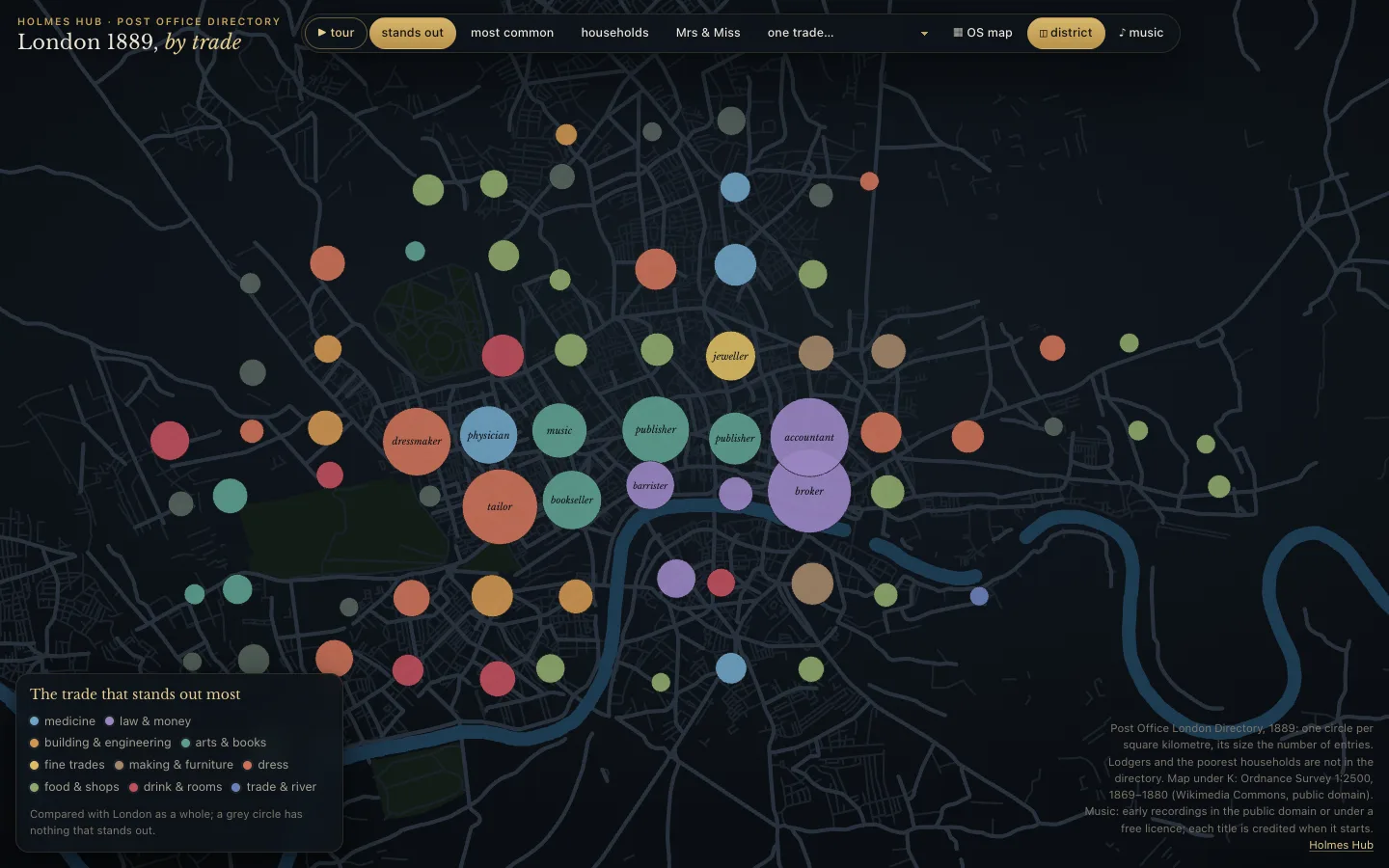
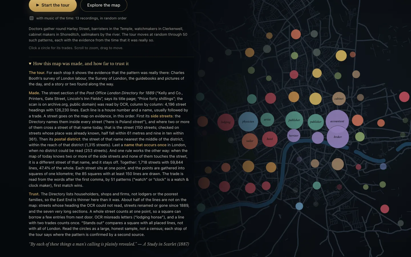
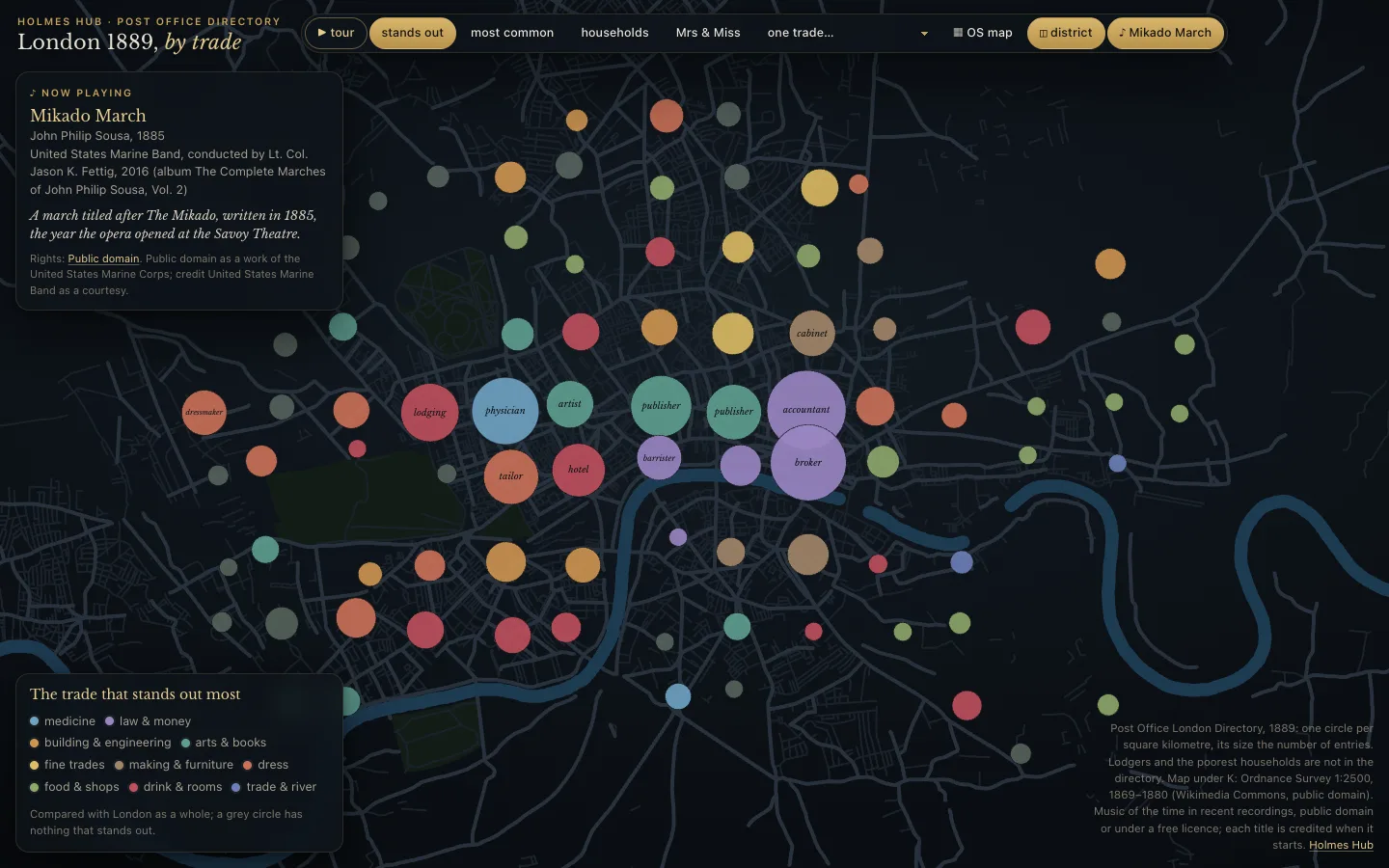
London 1889, by trade is a map of its own. The Post Office London Directory of 1889 lists, street by street and house by house, who was there and what they did. This page turns 59,844 of those lines, on 1,718 streets, into 85 circles: one for every square kilometre, as large as its number of entries.
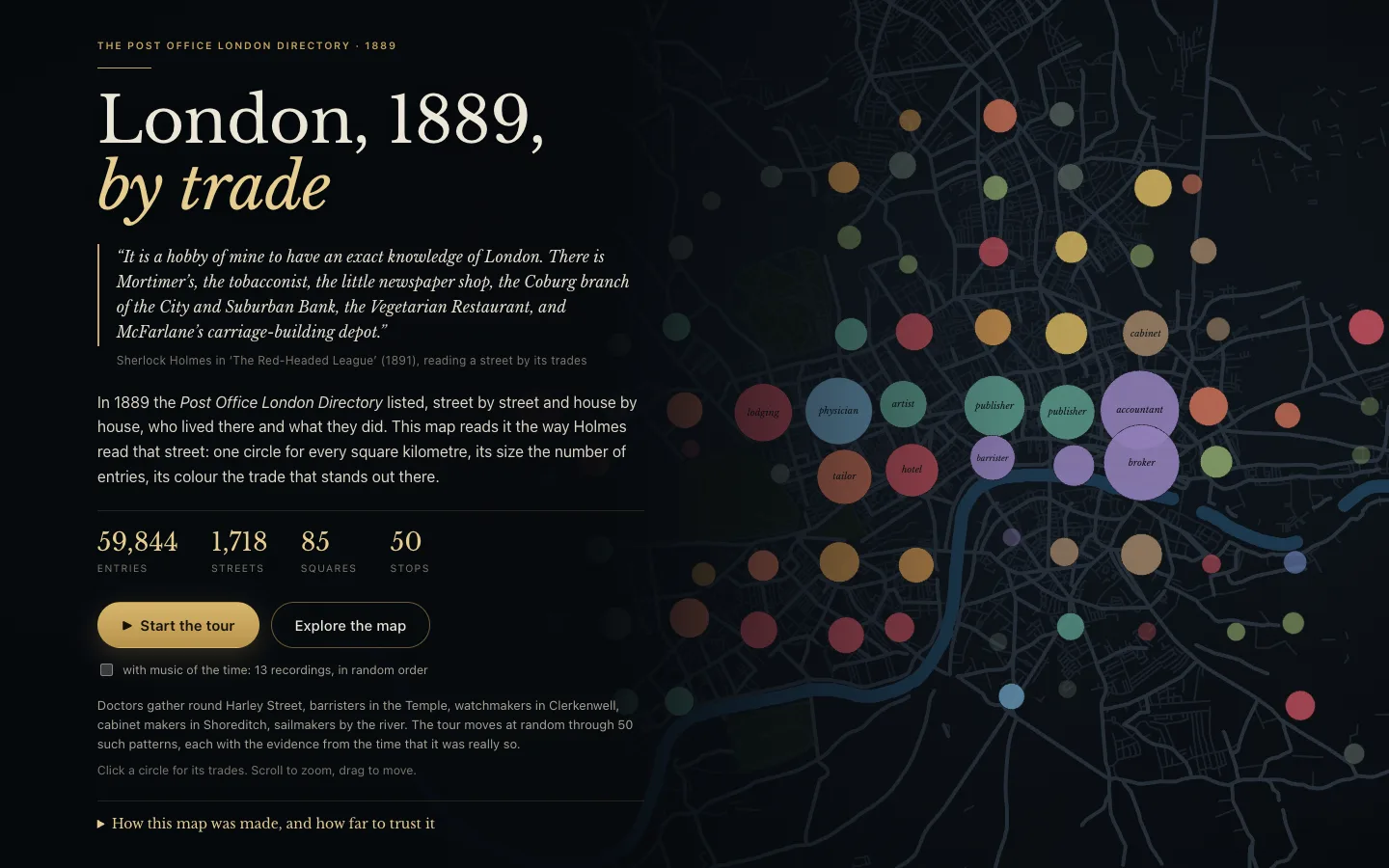
The opening page gives you two doors: Start the tour or Explore the map. Under How this map was made, and how far to trust it it says plainly what the map is and is not: which book it comes from, how the lines were read, which streets could be placed (47.4% of all lines), and what is missing. A street goes on the map on evidence: first its side streets, which the Directory names inside every street and which must cross a street of that name today (150 streets, Oxford Street and Hatton Garden among them); then its postal district; last a name that occurs only once in London. When the side streets exist today and none of them touches the street, it is a different street of that name and it stays off the map. Lodgers and the poorest households are not in the directory. Read the circles as a large, honest sample, not a census.
Four ways to look
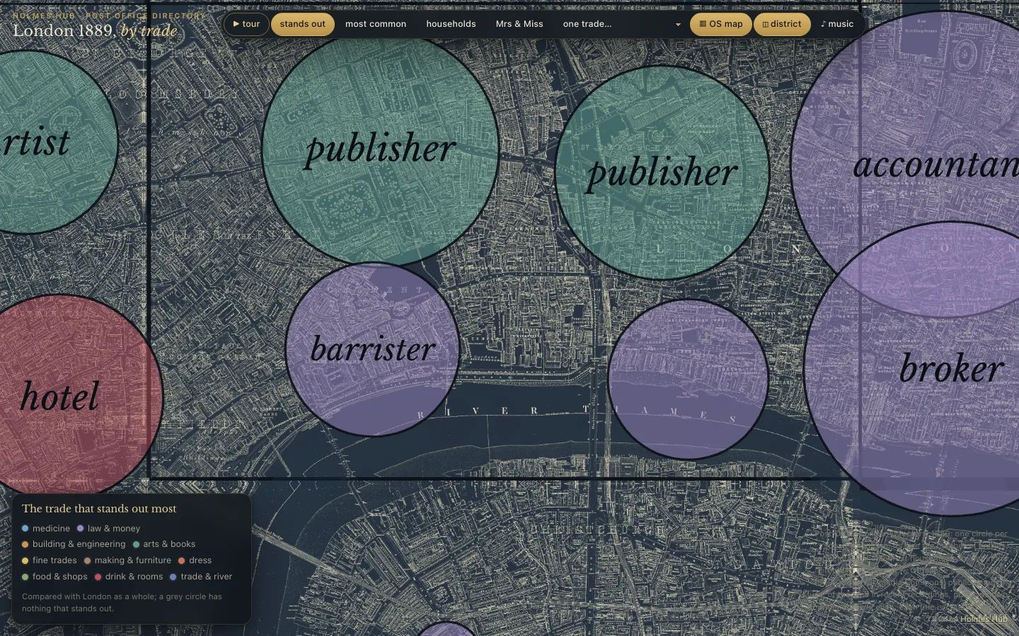
- stands out: the trade that is most over-represented in that square, compared with all of London. This is where the map starts.
- most common: the trade with the most entries there.
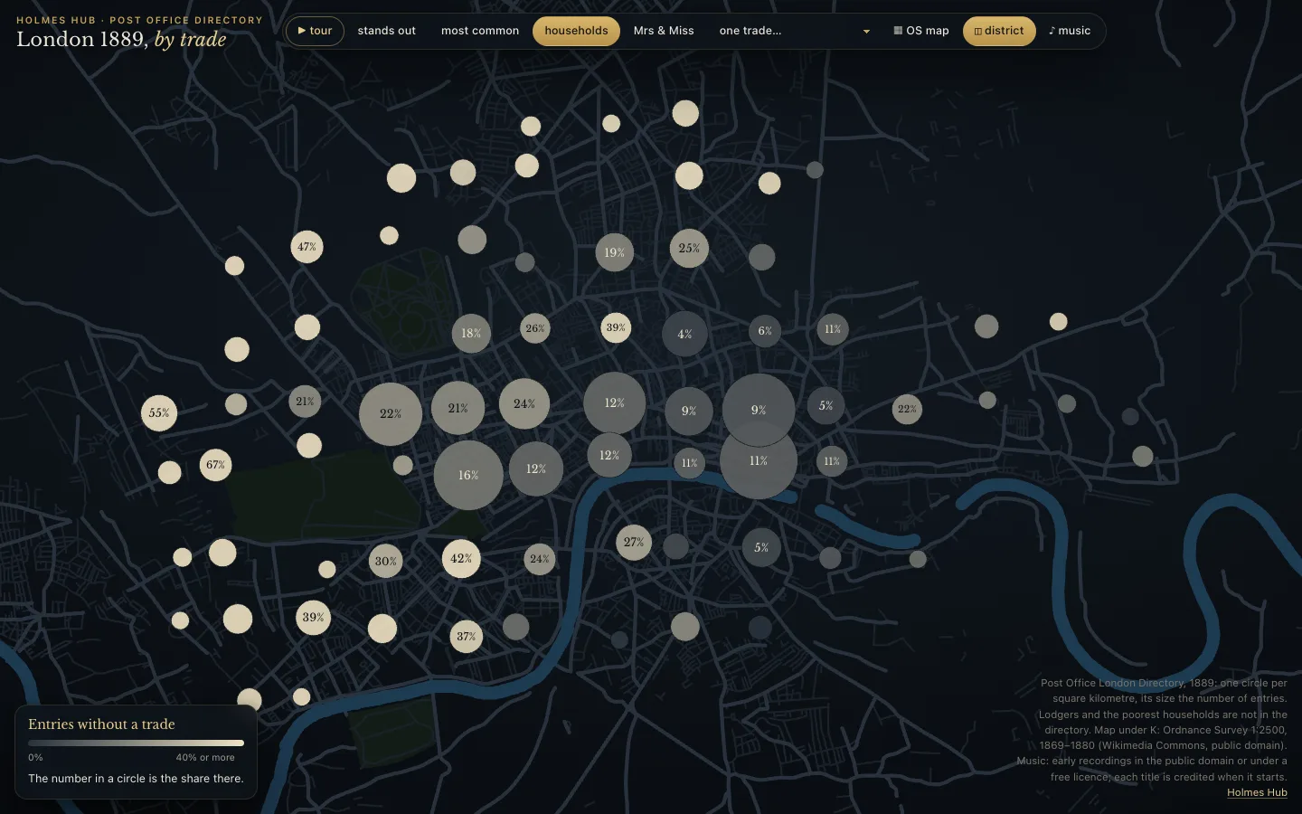
- households: the share of entries without any trade, from slate (few) to parchment (many), with the percentage in the circle.
- Mrs & Miss: the share of entries headed by a Mrs or a Miss.
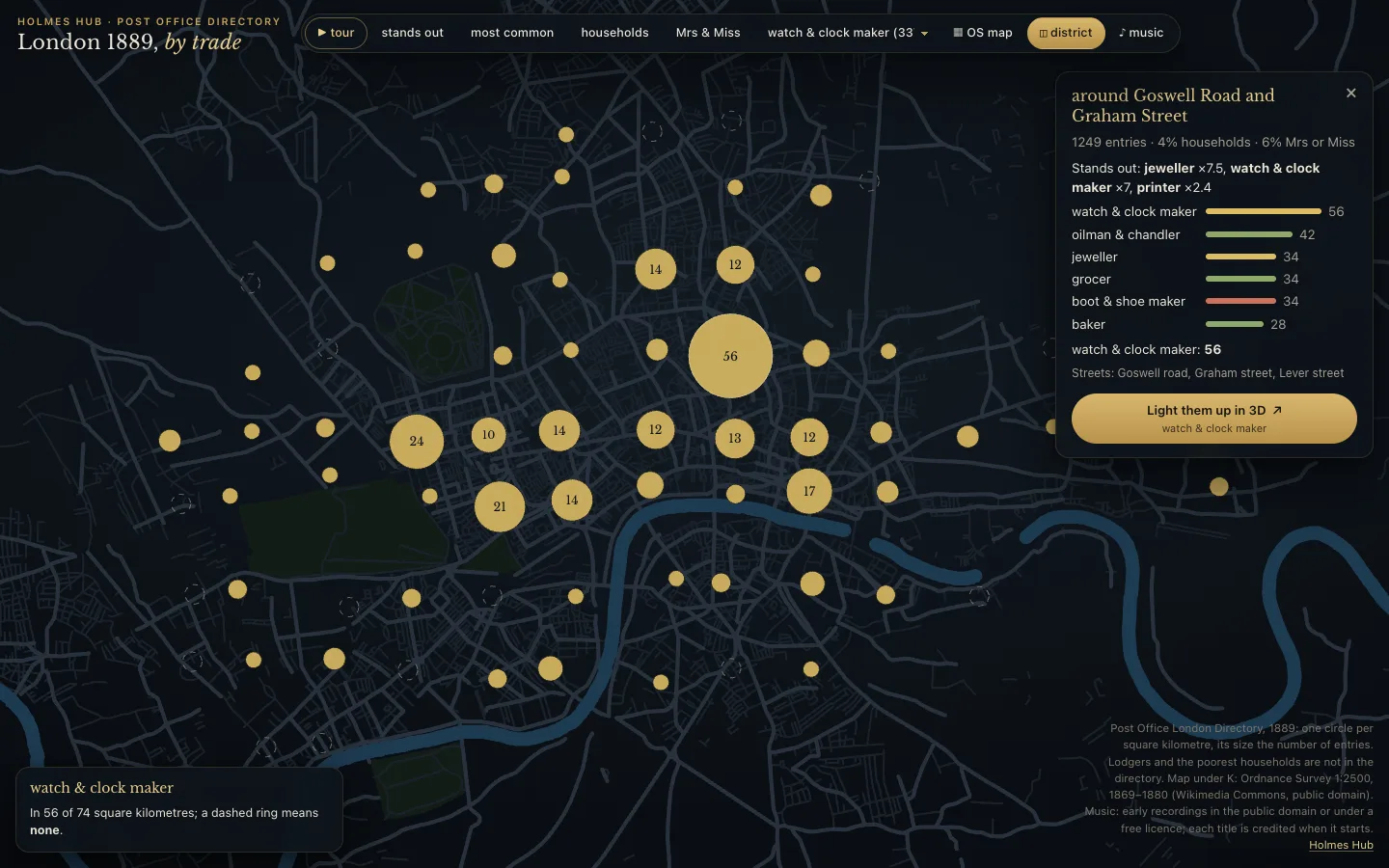
- one trade…: pick any of the fifty-one trades and see where it sits. A dashed ring means none.
A circle and its card
Hover a circle for its card: the streets it is built from, how many entries, the trades that stand out and the six largest. Click a circle and it stays chosen while you move over the others; close the card, or click another circle, to let go. With several trades at once a circle becomes a ring, one colour per trade, with the total in the middle.
The tour
▶ tour moves at random through 50 stops, a different order every time. Each stop flies to one circle and tells one thing the directory shows there, in a card with a picture of the time: what the numbers are, why it was so, and a short story found along the way. 23 of the stops carry a sentence of Doyle’s own. The arrows step back and forward (so do the arrow keys), ❚❚ or the space bar pauses, and Esc or a click on the map ends the tour.
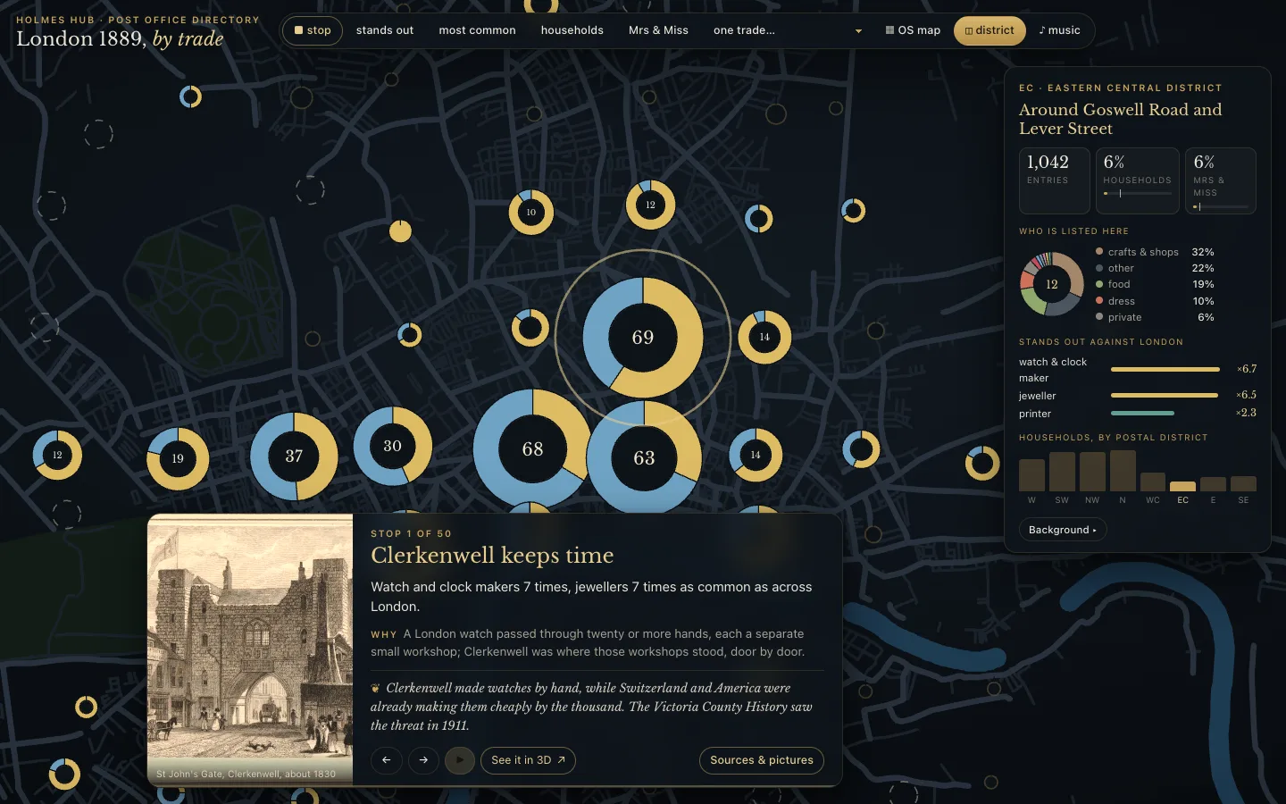
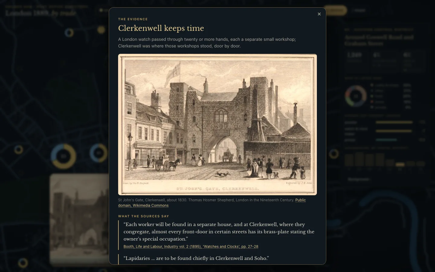
Sources & pictures opens the evidence: the picture with its maker and licence, the sentences from the sources word for word (Charles Booth’s survey of London labour, the Survey of London, guidebooks of the day), each with a link to the page it was read on, and under In Holmes’s own words the line from the story. Every quotation was fetched again and compared letter by letter before it went in; a stop whose quotation could not be found on the page it names is not shown.
The district card
During the tour a card top right gives the figures of that square kilometre: entries, households and Mrs & Miss against London as a whole, a small ring of who is listed, the trades that stand out, and the eight postal districts side by side. Background folds out the fine print. The district button switches the card off and on.
The Ordnance Survey underneath
K, or the OS map button, lays the Ordnance Survey of 1869–1880 under the circles: sixteen sheets at 1:2500, every house and yard as it was drawn, turned to slate with light lines so they sit in the page. The circles turn translucent so the streets show through. Zoom in and the map can be read: street names, squares, the names printed on the larger buildings. Press K again to take the map away. The sheets load the first time you ask for them.
How a street finds its place
The Directory gives a street a name and a postal district, not a position. Each street is put on the map on evidence, and the opening page shows the count for every kind:
- Its side streets. Inside every street the Directory notes where another street joins (“here is Poland street”). Where two or more of those cross a street of that name on the map of today, that is the street. This is how Oxford Street, Hatton Garden, Cheapside and Mincing Lane came onto the map, and how Queen’s Road found its way back to Bayswater, where it is now called Queensway. Tested on streets whose place was already known, half the results fall within 61 metres and nine in ten within 361.
- Its postal district. Of the streets of that name, the one nearest the middle of the district, within that district’s reach.
- A name that occurs once in London, when the district could not be read.
Two rules take streets off the map. When the map of today knows two or more of the side streets and none of them touches the street, it is another street of that name, or one that has since been renamed. And one street belongs to one district: three sections called Wellington Street from three districts cannot all be the one by the Strand. One idea was tried and dropped: placing a street whose name no longer exists at the point where its side streets meet. With the name left out, that put one known street in eight more than a kilometre from where it really is, so it is not used.
Into 3D
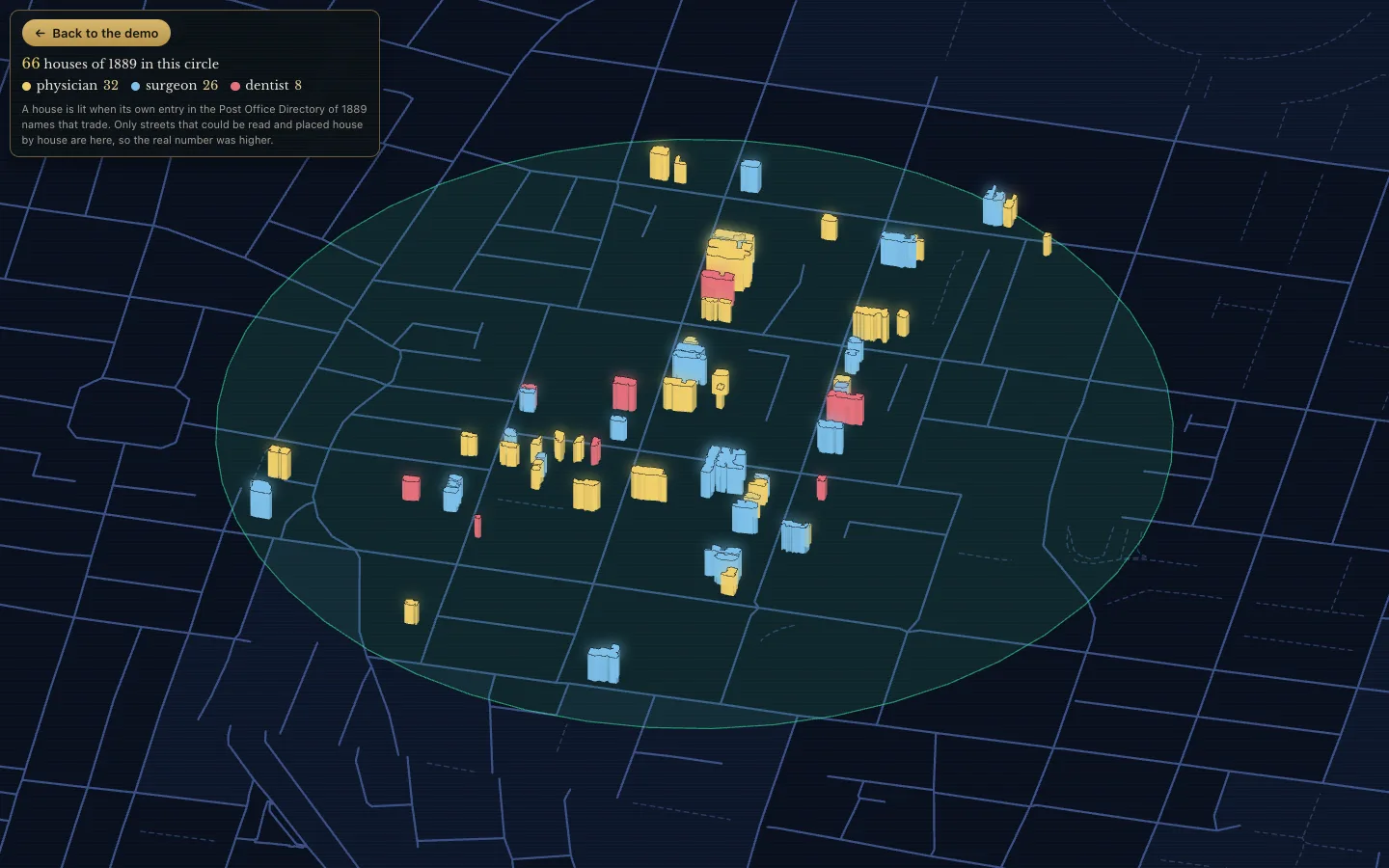
See it in 3D on a stop, or Light them up in 3D on a circle’s card, takes that square kilometre into the 3D city. The view opens full screen, without the menus: the camera comes in from above onto a disc of ground and stays there, so you can look around. A house lights up only when its own entry in the Directory of 1889 fits the subject of the stop: a physician’s house in the doctors’ quarter, a watchmaker’s in Clerkenwell. The card top left counts the lit houses in the circle, trade by trade. Back to the demo, on that card, returns to the same stop and the tour goes on. The button is only there where at least five such houses stand on the spot. The Directory could be tied to a house in only part of London’s streets, so the real number was higher.
Music
♪ music is off until you ask for it. It plays 13 pieces of the time in recent, clean recordings, in random order: Sullivan and Offenbach by the United States Marine Band, the overture to The Gondoliers of 1889, Chopin and Mendelssohn, Sarasate, whom Holmes goes to hear at St James’s Hall, a street organ, and a Polyphon music box with a disc of 1890. When a piece starts a card names it: the title, who wrote it, who plays, why it belongs to London in 1889, and whose recording it is and under which licence. The first pool, wax cylinders and shellac of the 1890s, crackled too much to listen to and is no longer played.
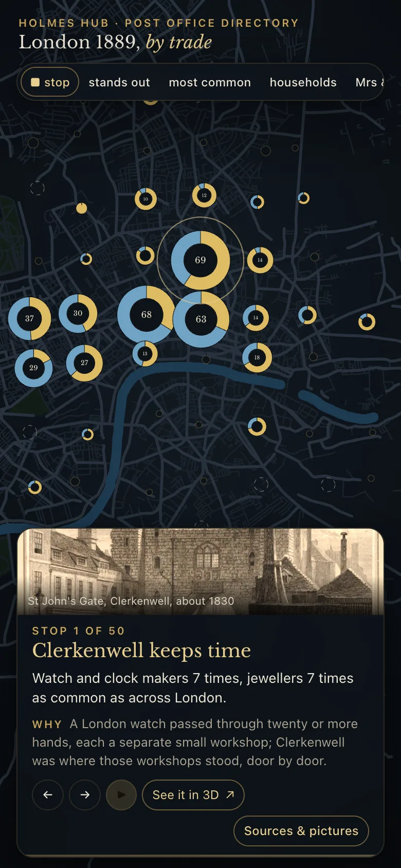
On a phone the same page works by touch: drag, pinch, tap a circle; the tour card sits at the bottom with the picture on top.
Who lived here in 1889
“By each of these things a man’s calling is plainly revealed.”Sherlock Holmes, A Study in Scarlet
Zoom into a street in 3D and the houses take colour: each colour is a kind of resident from the directory of 1889, from doctors and private households to shops, public houses and pawnbrokers. On All of London that covers 19,701 houses in 918 streets; each of the five districts shows the streets that were worked out there.
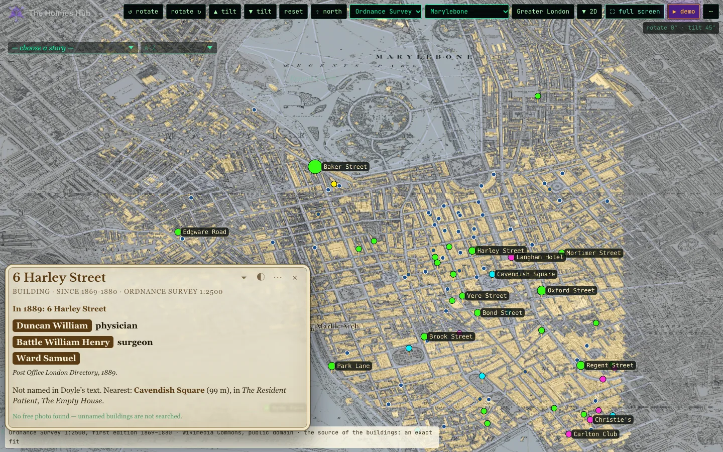
Click a house and its card is headed with its address of 1889. Below it stand the people the Directory lists there: the name on a dark label and the trade in bold beside it, so the two cannot be confused. The list of the whole block further down stays in plain text. The trade is given as it was meant: the Directory’s own abbreviations are written out (lodging ho is a lodging house, dressma a dressmaker) and misreadings of the scan are put right where the reading is certain. A few dozen lines that cannot be read are left as the scan gave them. Names are shown as they were read, except a first name the scan misread in a known way (Isracl for Israel, Jobn for John): that is put back to the common name it was. Above the names, in bold, stands what is special about the house: a Mrs or a Miss at the door, an institution, drink sold, a pawnbroker, lodgings let.
Where the old numbers could be checked against today’s, the card says In 1889: 110 Harley Street. Where the numbering has changed, the house is placed by its order along the street, between two side streets or between a side street and the end of the street; the card says about no. and estimated, and it lists the whole block as well. One house carries one number. The side streets are looked up under the name they bear now, the name they bore in 1889, and the name the London County Council gave them since: the Directory’s Castle street east is Eastcastle Street on the map.
Where even that fails (the side streets cannot be found, or the numbers run up one side and back down the other), the house is roughly placed: its number sets its place along the street, number 1 at the end the side streets or today’s numbers point to, odd facing even unless the numbers run back. The card says so. Tested on streets where the true house is known, about four in ten of these land within a hundred metres of it: the right street and roughly the right part, no more. Squares and crescents are left out.
Who was this resident? For 227 of them something more is known. Where a doctor, an artist, an architect or a musician of the same name, alive and grown in 1889 and of the same calling, is found in Wikidata, Wikipedia or Munk’s Roll of the Royal College of Physicians, the card adds a line under the name: Of this name: Felix Semon (1849–1921), German-British laryngologist, with a link. It says of this name because a name and a calling are not proof of an address; where the Wikipedia article itself mentions the street, the card says that instead. A name that fits more than one person is left alone, and so is a namesake from another country.
How good is an estimate? Tested on the streets where the house number is known, half of the estimated houses stand within 21 metres of the true one and 59 in a hundred within 30 metres: the right stretch of the street, not always the right door.
Famous residents
A blue disc on a roof marks a commemorative plaque: 196 of them, for people who were alive and grown in 1889. Click the house and a second card opens beside the first, in the blue of the plaque: the name, a portrait where a free one exists (123 have one), the words on the plaque itself, and a short life. The discs can be switched off and on in the … menu (famous residents), on every 3D map. A gold ring round the disc means the dates on the plaque include 1889 (28 plaques); otherwise the card says so: living elsewhere that year, or no dates given. A plaque is tied to a building by its address, or by where it hangs, never by a name alone; and a character in a story is not a resident, so Holmes himself has no disc.
The card of the house itself names the famous resident too, above the people the Directory lists there and in the same hand: the name on a dark label, the calling in bold, the years of birth and death, and whether the dates on the plaque include 1889.
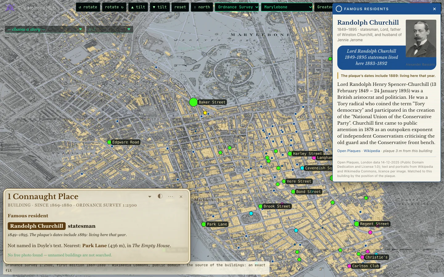
The plaques come from Open Plaques (public domain); the portraits and lives from Wikipedia and Wikimedia Commons, each with its licence on the card.
What the map itself says
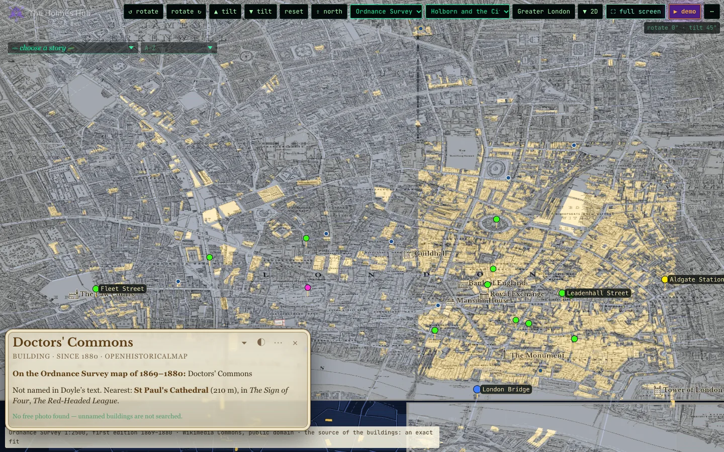
The Ordnance Survey printed a name on the larger buildings: Doctors’ Commons, Warehouses, Cordwainers’ Hall, Portland Road Station. Where such a name has been read from the sheet, the card of that building carries it as its title, with the line On the Ordnance Survey map of 1869–1880. The names are read from the image of the map itself, tile by tile, and only what is legible is taken over; nothing is completed from memory. So far 558 names are in, on the City and riverside sheets first; the rest of the map follows.
Stories told in 3D
“I am lost without my Boswell.”Sherlock Holmes, A Scandal in Bohemia
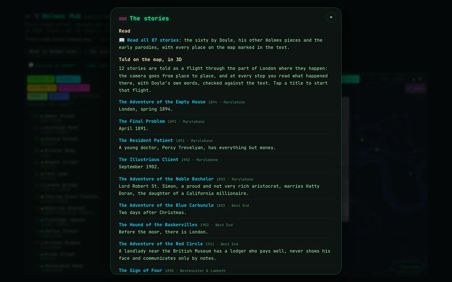
The stories, in the bar at the top, lists every story you can read and the stories that are told as a flight in 3D. Tap one and the camera goes from place to place through the part of London where it happened; at every stop you read what happened there, with Doyle’s own words, checked against the text.
Reading the stories
“Education never ends, Watson. It is a series of lessons with the greatest for the last.”Sherlock Holmes, The Red Circle
Read opens the library: all 87 stories, the sixty by Doyle, his pieces outside the canon, the early parodies and pastiches, with the illustrations of the day. Every text is in the public domain.
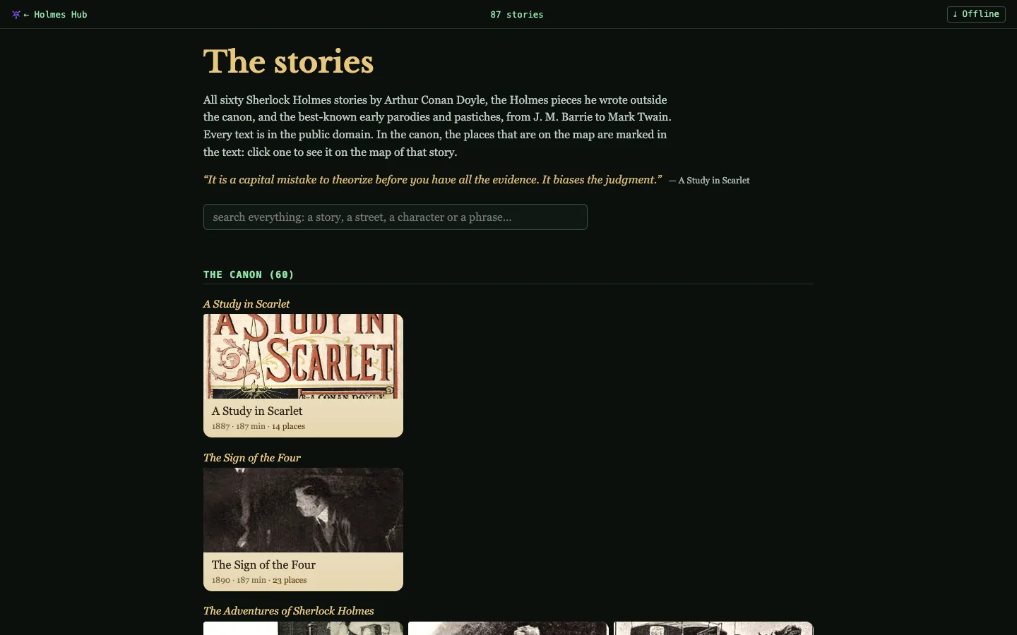
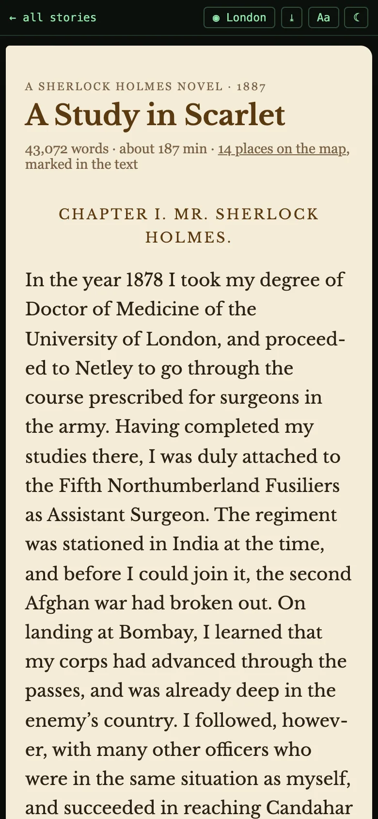
Inside a story, every place that is on the map is marked. Tap it and the map opens on that spot; close the map and you are back in the same sentence. This story’s London, at the top, shows all of the story’s places at once. Aa sets the size of the text, and the moon switches between light and dark.
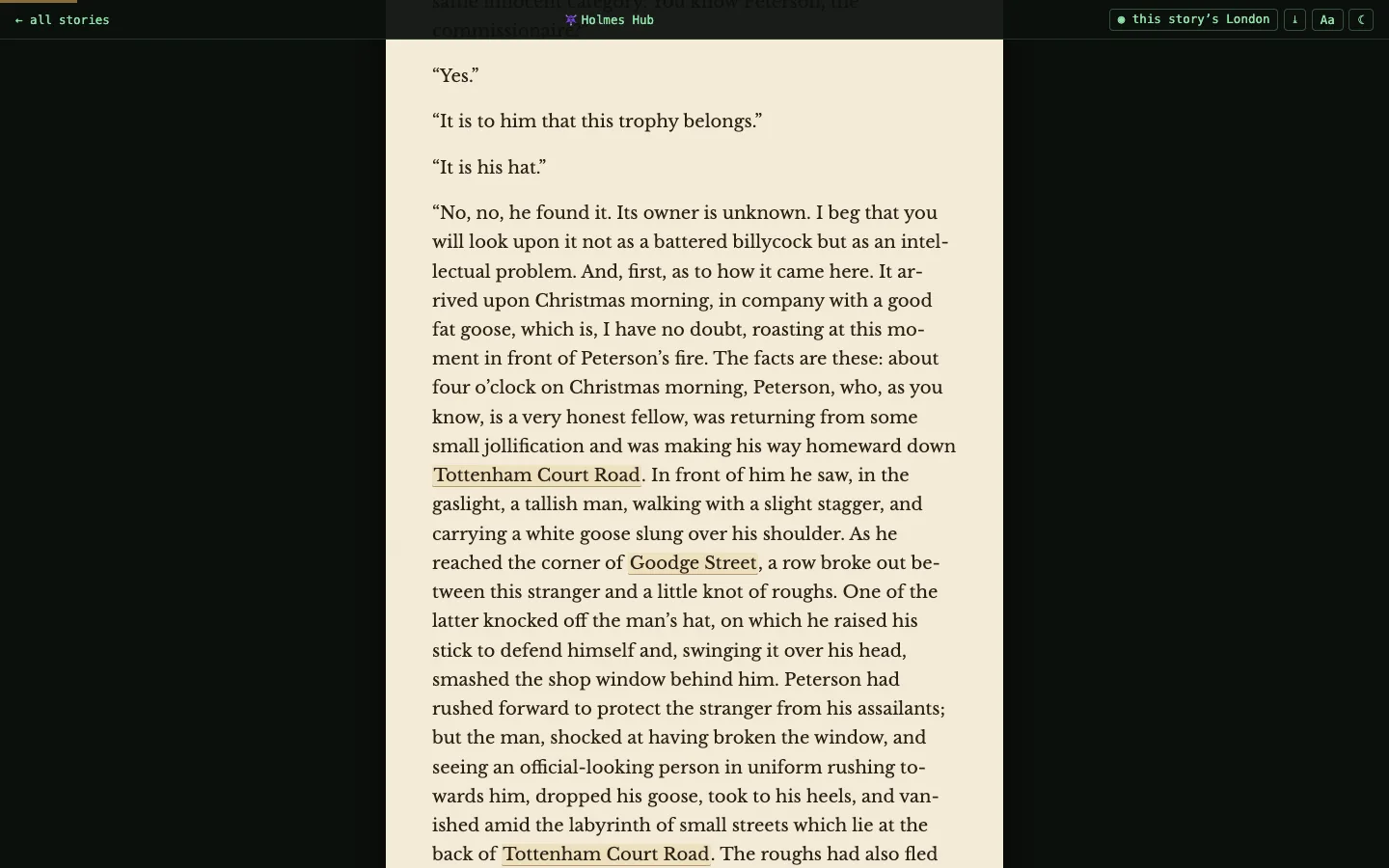
Read offline
⤓ Offline, in the bar above the map, in the library and on every story, saves Holmes Hub on your device, so you can read on a plane or anywhere you would rather not spend data.
- This story: the one you are reading.
- Light: every story as text, and the map of 1889 with all its places.
- Medium: adds the illustrations, the photos, Booth’s map of 1889 and Marylebone in 3D.
- Heavy: all of London, every old map and every district in 3D. For a tablet with room to spare.
The window shows how much each takes and how much room your device has. Remove saved clears it again. On an iPhone, add Holmes Hub to your home screen first and save from there, or Safari may clear it after a week without a visit.
On a phone
“Come at once if convenient—if inconvenient come all the same.”Sherlock Holmes, by telegram, The Creeping Man
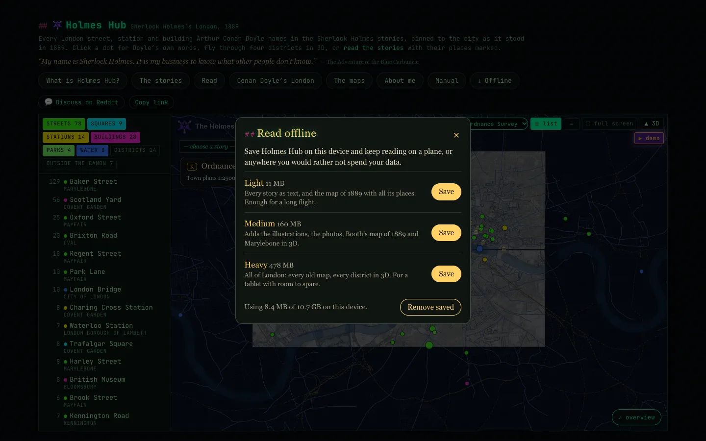
The first time you open Holmes Hub on a phone, it starts with a page of A Study in Scarlet beside the map of 1889. Open the books takes you to the library; from there a place in a story is the way into the city, and a light in the city is the way back into the story.
Pinch to zoom, on the flat map and in 3D. The small gold dot bottom left clears every menu away, leaving only the map and its pins; tap it again to bring them back. The map list and the story list are dropdowns.
Names London doesn't know
“It is my business to know what other people don’t know.”Sherlock Holmes, The Blue Carbuncle
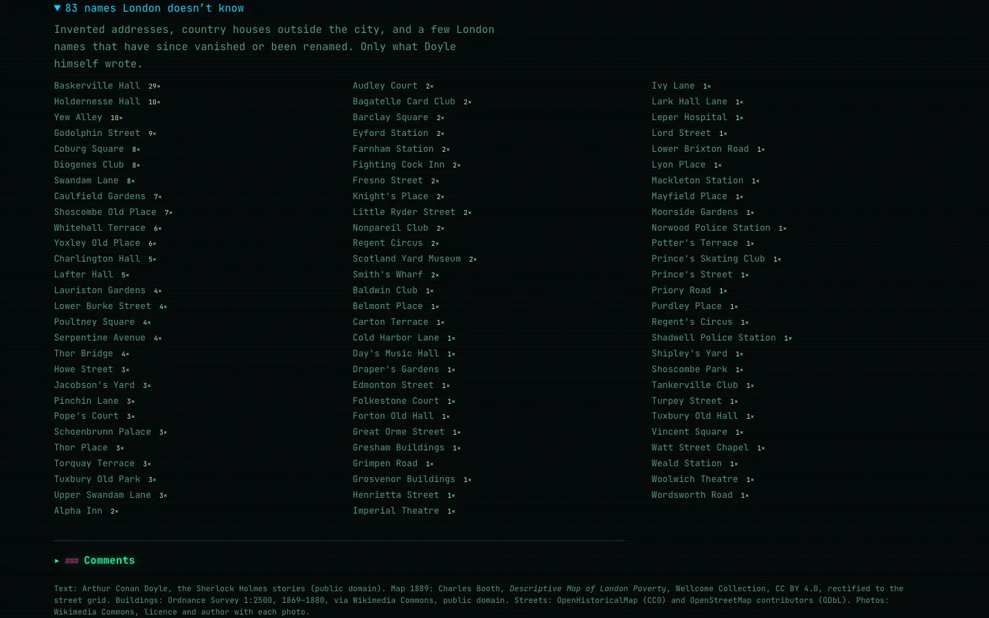
At the bottom of the flat map are 83 names London doesn’t know: places from the stories that no map has. Most are Doyle’s own inventions, like Baskerville Hall or Saxe-Coburg Square; a few may be streets London has since swallowed or renamed. Spot one you can place? Tell us in the comments. When you have eliminated the impossible, whatever remains must be a real street.
How the map was made
“I never guess. It is a shocking habit,—destructive to the logical faculty.”Sherlock Holmes, The Sign of the Four
Only what Doyle wrote. Every place name was pulled from the complete canon and looked up within London. A place is on the map only if Doyle himself names it; editors’ notes and later additions are left out. Every card quotes his own sentence.
The streets of 1889 come from OpenHistoricalMap: only streets that demonstrably existed in 1889, not today’s. The buildings in 3D are traced one by one from the Ordnance Survey town plans of 1869–80; where those leave a block empty, from the 1:1056 survey of 1891–96 as traced by Petitpierre and others (Zenodo, CC BY 4.0). The old maps come from the Wellcome Collection (Booth 1889), the LSE and Wikimedia Commons (Booth 1898–99, the Ordnance Survey) and the BnF (Bacon), each fitted to the streets of 1889.
Checked, and checked again. Every pin was compared with the street, square, station or building of the same name, and moved where it was off. Readers help: a reader on Reddit noticed that Waterloo Bridge sat on Waterloo station, and after that every place was checked the same way. Stations sit on the station as it was (Woolwich Arsenal, not the Elizabeth line of 2022), corners Doyle names sit on the corner, and names that appeared twice became one. A place whose position cannot be established goes to the names London doesn’t know, not onto the map: better not on the map than in the wrong spot.
Photos come from Wikimedia Commons under free licences, with the maker and licence on every card. They show the place itself, the oldest first, and every one was looked at by hand before it went on the map.
Keyboard shortcuts
“I am a brain, Watson. The rest of me is a mere appendix.”Sherlock Holmes, The Mazarin Stone
| Key | Flat map | 3D |
|---|---|---|
| F | full screen | full screen |
| K | next old map | the Ordnance Survey on and off |
| L | hide or show the list | — |
| Q / E | — | rotate |
| W / S | — | tilt |
| R | — | reset the view |
| N | — | north up |
| Esc | stop the demo, leave full screen | stop the demo, leave full screen |
On London 1889, by trade: K the Ordnance Survey under the circles, Space pause and resume the tour, ← / → the previous and next stop, Esc close the evidence or stop the tour.
Questions
“Not invisible but unnoticed, Watson.”Sherlock Holmes, A Case of Identity
It is slow on my phone.
All of London in 3D is heavy. Start with Marylebone, the lightest district, or stay on the flat map, which works on any phone.
A place is in the wrong spot.
Tell us in the comments, with the story and the sentence. Every report so far has led to a correction.
Why is a place I know not on the map?
Because Doyle does not name it, or because we could not establish where it stood. The second kind is listed at the bottom of the map among the names London doesn’t know.
How do I reach you?
By e-mail. The address, with a small card, is at the bottom of About me on the start page; the link opens it for you. Corrections, sources I have missed and ideas are all welcome.
Where do I see what changed?
Under What’s new, at the bottom of this manual, day by day.
Further reading
“I have been guilty of several monographs. They are all upon technical subjects.”Sherlock Holmes, The Sign of the Four
Others have walked these streets long before this map. A few places to go on from here, each of them checked on 30 September 2026:
The societies. The Sherlock Holmes Society of London, founded in 1951, runs walks, talks and the twice-yearly Sherlock Holmes Journal. In New York, The Baker Street Irregulars is the oldest literary society devoted to Holmes; The Beacon Society brings the stories into schools.
On Doyle and the stories. The Arthur Conan Doyle Encyclopedia collects Doyle’s writing, the first editions and the illustrations, and Sherlockian.net is a long-running guide to Holmes scholarship. The texts themselves are free at Project Gutenberg.
On Victorian London. Lee Jackson’s Dictionary of Victorian London gathers what Londoners of the time wrote about their own city; The Victorian Web covers the century around it.
The maps. Charles Booth’s London at the LSE has the poverty maps and the notebooks behind them; Layers of London and MAPCO lay other old maps of the city side by side.
Books. Michael Harrison, In the Footsteps of Sherlock Holmes (1958), one of the first books to go looking for the London of the stories; Thomas Bruce Wheeler, The London of Sherlock Holmes (2011), more than 400 sites in Greater London, grouped by Underground station; Rose Shepherd, Sherlock Holmes’s London (2016), a guidebook for walking it today. And to stand in the rooms: the Sherlock Holmes Museum in Baker Street, which carries the number 221B.
The same list sits at the bottom of Conan Doyle’s London on the start page.
What's new
“There is nothing new under the sun. It has all been done before.”Sherlock Holmes, A Study in Scarlet
Day by day, newest first. Each entry links to the place on the site where the feature lives.
- 2 Oct, evening The empty blocks filled, and more of the trades tour in 3D. Where the survey of the 1870s left a block blank, the houses now come from the Ordnance Survey of 1891–96 at 1:1056, as traced by Petitpierre and others (CC BY 4.0): All of London grew from 143,477 to 301,627 buildings. With more houses to stand in, 19,701 houses in 918 streets now carry their own lines from the Directory, and in London 1889, by trade 29 of the 50 stops can now be seen in 3D, up from 16: Shoreditch makes furniture lights up 56 houses instead of 10, Clerkenwell keeps time 52 instead of 19, and The street of tea, Paternoster Row’s books and Hops in the inn yards have a 3D view for the first time.
- 2 Oct, afternoon Twice as many houses again, roughly placed. On All of London 15,459 houses in 832 streets now carry their residents of 1889, up from 6,499: 17,780 directory lines on the cards. Where a street’s side streets could not be found or its numbers run back down the other side, a house now takes its place along the street by its number; the card says roughly placed, because about four in ten of these land within a hundred metres of the true house. First names the scan misread in a known way are put right: the landlord of the George & Dragon at 104 Houndsditch is Israel, not Isracl, Myer.
- 2 Oct, morning Who was this resident? It began with Angel Money, physician at 24 Harley Street, who turned out to stand in Munk’s Roll of the Royal College of Physicians. Now the house cards look for themselves: where a doctor, artist, architect or musician of the same name and calling, alive and grown in 1889, stands in Wikidata, Wikipedia or Munk’s Roll, the card says Of this name, gives the years and links to the source. The Directory’s “Carter Brudenell, surgeon” of Queen Anne Street is Robert Brudenell Carter, the ophthalmic surgeon. A name that fits two people is left alone.
- 2 Oct, morning More residents on the cards. 5,763 directory lines now stand on the house cards of All of London, up from 4,497. The Directory prints a full stop, not a comma, after a shortened first name (Wharton Thos. Geo. auctioneer), and those lines were being dropped as unreadable; firms such as Sibley & Linney, tailors now count as names too.
- 2 Oct, morning Name and trade, told apart. On a house card in 3D the resident’s name now stands on a dark label with the trade in bold beside it, and a house with a plaque names its famous resident the same way: Lawrence Alma-Tadema, painter. The trades read as they were meant: the Directory’s own abbreviations are written out (lodging ho is a lodging house), and some 1,100 shortened or misread trades were put right, by rule where the rule is certain and by eye where it is not. Forty-seven lines that cannot be read are left as the scan gave them.
- 2 Oct, night Half as many houses again. On All of London 6,499 houses in 576 streets now carry their residents of 1889, up from 4,187 in 542. Two things did it. The two ends of a street now count as boundaries, so the houses before its first side street and after its last are placed too. And side streets are found under their old names, with the London County Council’s list of renamed streets: the Directory’s Castle Street East is Eastcastle Street on the map. A count of where the Directory’s lines fall away showed where to look. Tested where the house number is known, half of the estimated houses stand within some 20 metres of the true one.
- 1 Oct, midnight Into 3D, full screen. The step from a stop of the trades tour into 3D now fills the screen, without the menus: only the city, the count of lit houses, and the way back to the tour.
- 1 Oct, early evening Music of the time, in recordings you can listen to. Thirteen pieces under the trades tour, in random order and off until you ask: Sullivan, Offenbach and Sousa’s Mikado March by the United States Marine Band, the overture to The Gondoliers of 1889, Chopin and Mendelssohn, Sarasate, a street organ and a Polyphon music box. A card names each piece when it starts: who wrote it, who plays, why it belongs here and whose recording it is. The wax cylinders of the first try crackled too much and are gone.
- 1 Oct, late afternoon What the map itself says. The Ordnance Survey printed names on the larger buildings, and the first of them are now on the cards in 3D: Doctors’ Commons and the warehouses south of St Paul’s, Cordwainers’ Hall, Portland Road Station, the National Orthopaedic Hospital. They are read from the map itself, tile by tile, and only what is legible is taken over; the City and the riverside come first. On the trades map the Ordnance Survey under K is now a slate sheet with light lines that can be read when you zoom in.
Doctors’ Commons, as the Ordnance Survey printed it. - 1 Oct, late afternoon Streets found by their side streets. The Directory names the side streets inside every street (“here is Poland street”); where two or more of them cross a street of that name today, that is the street. Oxford Street, Hatton Garden, Cheapside, Mincing Lane and Borough High Street are on the trades map at last, and Queen’s Road is back in Bayswater, where it is now called Queensway. A street whose side streets exist but never touch it stays off. The tour now has fifty stops, and the numbers in every stop are filled in from the data, so they move when the map does. In 3D the blue discs of the famous residents can be switched off in the … menu.
- 1 Oct, afternoon Forty-eight stops, in a different order every time. The tour of London 1889, by trade grew from twelve stops to forty-eight: Colonel Moran’s Conduit Street among the military tailors, the stolen Duchess of Old Bond Street, Watson’s bank at Charing Cross, the diamond merchants of Hatton Garden, the book this whole map is made from. Every stop has a picture of the time, the reason why, a story found along the way and its sources quoted word for word; twenty-one carry a sentence of Doyle’s own. Each quotation was fetched again and compared letter by letter before it went in. Pause with the space bar; a circle you click stays chosen.
A stop of the tour, with the district card top right. - 1 Oct, afternoon From a circle into the streets. See it in 3D flies into that square kilometre of the 3D city and raises only the buildings the stop is about: bright where the directory entry could be tied to the very house, soft with a street label and a count where only the street is known. Back to the demo takes you back and the tour goes on. And K lays the Ordnance Survey under the circles of the flat trades map.
Solicitors by the Temple: streets with their counts. - 1 Oct, midday Famous residents. A blue disc on a roof in 3D marks a commemorative plaque, 196 of them, for people who were alive and grown in 1889; the house opens a second card with a portrait, the words on the plaque and a short life. A gold ring means the plaque’s own dates include 1889. Plaques from Open Plaques, tied to a building by address or position, never by a name alone.
Lord Randolph Churchill at 2 Connaught Place. - 1 Oct, midday Proof for every stop. Each stop of the trades tour now says why the pattern was really so, with the evidence a click away: Charles Booth’s survey of London labour, the Survey of London, the guidebooks and pictures of the day. A new opening page with Holmes reading a street by its trades, and under it how the map was made and how far to trust it. A new look for the whole page, a district card with the figures of each square kilometre, and rings instead of pies.
- 1 Oct, morning Who lived here in 1889, house by house. On All of London 4,187 houses in 542 streets now carry their residents from the Post Office London Directory: zoom in and the houses take colour, click one and its card is headed with its address of 1889, with what is special about it in bold. One house carries one number; where the numbering has changed since, the card says about and estimated.
A house in Harley Street and who is listed there in 1889. - 1 Oct, morning London 1889, by trade: a new map. 53,702 lines of the Post Office London Directory on 1,583 streets, one circle for every square kilometre, coloured by the trade that stands out: doctors round Harley Street, barristers in the Temple, watchmakers in Clerkenwell, cabinet makers in Shoreditch. With a tour, and three stories in 3D about who lived in Harley Street, Cleveland Street and Brick Lane.
One word per square kilometre. - 30 Sep Version 1.0. Four days after going online, Holmes Hub is whole: the London of the stories on the map as it stood in 1889, four maps of the time, five districts and all of London in 3D, a demo that tells the story, the library to read in, offline too, and a manual with pictures of everything. The site rests here for a while; corrections from readers still go in.
Holmes Hub 1.0: the start page on a computer. - 30 Sep, midday Landmark names in a bolder, darker hand that reads on every map, and two new settings in the … menu: landmark size and landmark colour, from sepia ink to gaslight gold. And the Ordnance Survey now lies under all of London in 3D too.
Landmarks in gaslight gold at 160%, around Westminster. - 30 Sep, late morning Every landmark is now a miniature of itself, as it stood in 1889, and a click opens its card with photographs and engravings from its own day: the Tower from the river in 1889, Lambeth Palace in 1858, Nelson’s Column still in scaffolding in 1844.
The Tower of London as a miniature, and its card with engravings of 1889. - 30 Sep, late morning Further reading under Conan Doyle’s London: the Sherlock Holmes Society of London, the Baker Street Irregulars, the Arthur Conan Doyle Encyclopedia, Charles Booth’s London and more, and three books that went looking for Holmes’s London before us.
- 30 Sep, late morning Landmarks to find your way: twenty-three buildings that already stood in 1889, from Big Ben and Westminster Abbey to the Tower, the Monument and Cleopatra’s Needle, as small gold buildings on the flat map and at roof height in 3D. And a full Manual, with an index, a search box and pictures of everything.
Lambeth Palace in 3D, with the palace in 1890, 1858 and 1873. - 30 Sep, morning The logo at the top always takes you home, on the flat map, in 3D and in the stories. Story headings with an apostrophe read properly again (St George’s, Hanover Square in The Noble Bachelor).
- 30 Sep Every place checked again. A reader on Reddit spotted Waterloo Bridge sitting on Waterloo station; it now stands on the river, and every pin was checked the same way. Street corners Doyle names are on the corner (Bentinck and Welbeck Street, The Final Problem); Montague Street is round the corner from the British Museum again; stations sit on the station as it was (Woolwich Arsenal, the main line at King’s Cross); the Crystal Palace is on the palace. Names that appear twice became one (Edgware Road, Paddington, Carlton House Terrace), and places that are in the editors’ notes but not in Doyle are gone, from Oxford Circus to Buckingham Palace. Every card now quotes Doyle’s own sentence.
- 30 Sep Photos of the place itself. A card no longer shows whatever building happens to be nearby: each photo is of the place, the oldest first (the old Waterloo Bridge in 1905, St. James’s Street around 1890), and every one of them was looked at by hand. Where no honest picture exists, there is none.
- 29 Sep, night The stories window lists the stories told in 3D; tap one to fly it. Full screen fills the whole phone.
- 29 Sep, afternoon The 3D pages have the same menu as the flat map, with the legend and the keys in the Manual. Every demo shows the Ordnance Survey at its stops, and in 3D every district flies the way All of London does. The flat map now starts with round pins in Neon Soho on night & gold.
- 29 Sep Search everything: places, all 4,090 streets of 1889, stories, districts, characters and every paragraph of every book, on the map and in the library. A street hit gets a gold pin you can tap; simpsons finds Simpson’s.
Search: simpsons finds Simpson’s. - 29 Sep Eighteen restaurants, hotels, clubs and shops from the stories on the map where they stood: Simpson’s in the Strand, the Café Royal, the Criterion Bar, the Langham, Claridge’s, St. James’s Hall, Christie’s, Sotheby’s in Wellington Street and more. Only real places; Goldini’s and the Northumberland Hotel stay out.
- 29 Sep One typeface for reading: Libre Baskerville in the stories and the cards, instead of the ornate scripts. On a phone the map menu sits in three tidy rows.
- 28 Sep, midnight The maps, a page of its own: the four old maps flowing one by one into the streets of 1889, each with its source, how it was fitted and what AI did with it. On the Ordnance Survey you can raise the buildings in 3D, on the same map. The full-screen maps now fill a phone screen too.
The maps page. - 28 Sep, night Lighter trips from a story to the map and a lighter demo: only the magnifying glass over our own map, no full old map behind it. One trip used to fetch over 100 MB of Ordnance Survey sheets. Back to the story now answers at once, even while the map is loading.
- 28 Sep, late Read offline: save a story, or Light, Medium or Heavy, and read on without a connection (). On a phone the map now shows its main roads at once and the streets come first, before the photos; a second visit opens straight from your device.
- 28 Sep, evening Full-screen maps in the … menu: Booth 1889, the Ordnance Survey, Booth 1898 or Bacon across the whole screen, with the pins on or off. On a phone, the step from a story into the city now waits behind a title card until London is there.
- 28 Sep A start page for phones: the book and the city side by side, and Open the books. Pinch to zoom on the flat map and in 3D; a gold dot bottom left clears the menus away.
- 28 Sep All of London in 3D: 143,477 buildings in one city, with a fair warning before it loads. Bacon’s map got its own slider under the map button.
- 28 Sep The 3D demo tells its stories with photos, and every pin stays clickable while it runs. District and map can be picked from the 3D … menu. Comments start folded.
- 27 Sep, evening The story is now told. Choose a story and press ▶ demo: the plot, summarised stop by stop around the places Doyle names, with his own sentence beneath each; only that story’s places stay on the map. Click the Holmes Hub mark in the corner of the map, here and in 3D, and it lights up.
- 27 Sep The demo on the flat map plays the story you have chosen, or picks one if you have not. The card on the map folds away and comes back; the phone layout has been tidied. Holmes himself, in profile, is the default pin (… menu). A small deerstalker in the corner of every page, and this manual got friendlier.
- 27 Sep Illustrations in the stories: 380 pictures from the magazines of the day, Paget and his contemporaries, placed beside the passage they belong to; a library of the 87 stories with pictures; a place name in a story links to the map and the map links back to the very paragraph.
The Blue Carbuncle, with the places linked to the map. - 27 Sep The stories: all sixty by Doyle, his pieces outside the canon, the early parodies and Leblanc’s Lupin-meets-Holmes, to read here. Eight stories that name no London place are listed as such; twelve stories are now linked to their places by the English text.
- 27 Sep A new demo on the flat map: a dot travels over a still map and at every stop a circle of the old map lifts off the city, smooth on a phone too. The maps now tells where every map comes from, what it is made of and how well it fits, with a picture of each. Pin themes, shapes and outlines in the … menu; the map name shows briefly top left.
- 27 Sep Manual; sorting of the story list; hover a dot inside a story for the sentence from that story; closing a card keeps you in the story; an overview button.
- 27 Sep Two more maps under the map button: Booth’s 1898–99 survey and Bacon’s map of the 1880s, reaching Norwood and Croydon. The Ordnance Survey now covers the City, Chelsea, Pimlico and Southwark; the seams between sheets are gone.
- 27 Sep Greater London: the districts Doyle names outside the centre, from Upper Norwood to Blackheath, after readers on r/SherlockHolmes asked for them.
- 27 Sep Every outlying place checked by hand. Church Street, Stepney is back in Stepney; the Metropolitan Station is Baker Street; places that were never in London are gone.
- 27 Sep A smoother 3D demo: it opens with a line of Doyle’s, flies from the whole city down to the street, and shows which map you are on. Photos in the cards, including 221B.
- 26 Sep Thirteen stories told on the 3D maps; the Whitechapel map of 1888; comments.
- 26 Sep Holmes Hub goes online.